City Bowl
Central business districts of South AfricaGeography of Cape Town

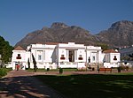
The City Bowl is a part of Cape Town in South Africa. It is a natural amphitheatre-shaped area bordered by Table Bay and defined by the mountains of Signal Hill, Lion's Head, Table Mountain and Devil's Peak. The area includes the central business district of Cape Town (CBD), the harbour, the Company's Garden, and the residential suburbs of De Waterkant, Devil's Peak Estate, District Six, Zonnebloem, Gardens, Higgovale, Oranjezicht, Schotsche Kloof, Tamboerskloof, University Estate, Vredehoek, Walmer Estate and Woodstock.
Excerpt from the Wikipedia article City Bowl (License: CC BY-SA 3.0, Authors, Images).City Bowl
Hopeville Street, Cape Town Cape Town Ward 115
Geographical coordinates (GPS) Address Nearby Places Show on map
Geographical coordinates (GPS)
| Latitude | Longitude |
|---|---|
| N -33.933333333333 ° | E 18.416666666667 ° |
Address
Good Hope Seminary High School
Hopeville Street
8001 Cape Town, Cape Town Ward 115
Western Cape, South Africa
Open on Google Maps


