Tunasan
Accuracy disputes from June 2016All accuracy disputesBarangays of Metro ManilaMuntinlupa

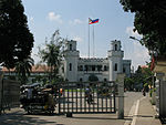
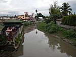
Tunasan is a barangay in Muntinlupa, Philippines. It is the southernmost barangay of Metro Manila located in the southern section of the city bordering the province of Laguna. The total land area of the barangay is 9.596 km2 (3.705 sq mi), the largest in the city. According to the 2020 census, it has a population of 61,374.Tunasan is located 27 kilometers (17 mi) south of the City of Manila. It is bounded by Poblacion, Muntinlupa on the north, Laguna de Bay on the east, the San Pedro barangays of San Antonio and Cuyab on the south; the Las Piñas barangay of Almanza Uno on the west; and Dasmariñas barangay of Salapan, province of Cavite, on the southwest.
Excerpt from the Wikipedia article Tunasan (License: CC BY-SA 3.0, Authors, Images).Tunasan
Santa Catalina Street, Muntinlupa
Geographical coordinates (GPS) Address Nearby Places Show on map
Geographical coordinates (GPS)
| Latitude | Longitude |
|---|---|
| N 14.372544444444 ° | E 121.03637777778 ° |
Address
Santa Catalina Street
Santa Catalina Street
1774 Muntinlupa
Philippines
Open on Google Maps


