Sint Maarten, North Holland
Former municipalities of North HollandNorth Holland geography stubsPages with non-numeric formatnum argumentsPopulated places in North HollandSchagen

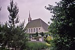
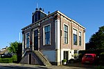
Sint Maarten (West Frisian: Simmer) is a village in the Dutch province of North Holland. It is a part of the municipality of Schagen, and lies about 15 km north of Alkmaar. The village was first mentioned in 1289 as Niwelant. The current name is a reference to Martin of Tours. Sint Maarten developed in the 13th century along the West-Frisian sea dike. A church was built in 1462, but was destroyed in 1799. In 1875, a new church was built and demolished in 1960.Sint Maarten was home to 246 people in 1840. It was a separate municipality until 1990, when it was merged with Harenkarspel. Harenkarspel merged with Schagen in 2013.
Excerpt from the Wikipedia article Sint Maarten, North Holland (License: CC BY-SA 3.0, Authors, Images).Sint Maarten, North Holland
Groenedijk, Schagen
Geographical coordinates (GPS) Address Nearby Places Show on map
Geographical coordinates (GPS)
| Latitude | Longitude |
|---|---|
| N 52.766666666667 ° | E 4.75 ° |
Address
Groenedijk
Groenedijk
1744 KM Schagen
North Holland, Netherlands
Open on Google Maps


