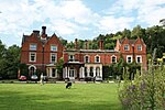
Box Hill, Surrey

Box Hill is a summit of the North Downs in Surrey, approximately 31 km (19 mi) south-west of London. The hill gets its name from the ancient box woodland found on the steepest west-facing chalk slopes overlooking the River Mole. The western part of the hill is owned and managed by the National Trust, whilst the village of Box Hill lies on higher ground to the east. The highest point is Betchworth Clump at 224 m (735 ft) above OD, although the Salomons Memorial (at 172 metres) overlooking the town of Dorking is the most popular viewpoint.Box Hill lies within the Surrey Hills Area of Outstanding Natural Beauty and forms part of the Mole Gap to Reigate Escarpment Site of Special Scientific Interest. The north- and south-facing slopes support an area of chalk downland, noted for its orchids and other rare plant species. The hill provides a habitat for 38 species of butterfly, and has given its name to a species of squash bug, now found throughout south-east England.An estimated 850,000 people visit Box Hill each year. The National Trust visitors' centre provides both a cafeteria and gift shop, and panoramic views of the western Weald may be enjoyed from the North Downs Way, a long-distance footpath that runs along the south-facing scarp slope. Box Hill featured prominently on the route of the 2012 Summer Olympics cycling road race events.
Excerpt from the Wikipedia article Box Hill, Surrey (License: CC BY-SA 3.0, Authors, Images).Box Hill, Surrey
Juniper Bottom (BW 159), Mole Valley Mickleham
Geographical coordinates (GPS) Address Nearby Places Show on map
Geographical coordinates (GPS)
| Latitude | Longitude |
|---|---|
| N 51.255 ° | E -0.30861111111111 ° |
Address
Juniper Bottom (BW 159)
Juniper Bottom (BW 159)
KT20 7JD Mole Valley, Mickleham
England, United Kingdom
Open on Google Maps


