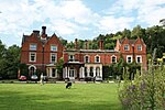
Mickleham, Surrey
1730 establishments in EnglandCivil parishes in SurreyCricket grounds in SurreyCricket in SurreyDefunct cricket grounds in England ... and 8 more
Defunct sports venues in SurreyEnglish cricket venues in the 18th centuryMole ValleySport in SurreySports venues completed in 1730Sports venues in SurreyUse British English from January 2014Villages in Surrey

Mickleham is a village in south east England, between the towns of Dorking and Leatherhead in Surrey. The civil parish covers 7.31 square kilometres (1,810 acres) and includes the hamlet of Fredley. The larger ecclesiastical parish includes the majority of the neighbouring village of Westhumble, from which Mickleham is separated by the River Mole.
Excerpt from the Wikipedia article Mickleham, Surrey (License: CC BY-SA 3.0, Authors, Images).Mickleham, Surrey
Dell Close, Mole Valley Mickleham
Geographical coordinates (GPS) Address Nearby Places Show on map
Geographical coordinates (GPS)
| Latitude | Longitude |
|---|---|
| N 51.268 ° | E -0.321 ° |
Address
Dell Close
RH5 6EE Mole Valley, Mickleham
England, United Kingdom
Open on Google Maps


