place

City of Banyule

1994 establishments in AustraliaCity of BanyuleGreater Melbourne (region)Local government areas of MelbournePopulated places established in 1994
Use Australian English from April 2018
MelbLGA Banyule
MelbLGA Banyule

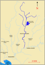
The City of Banyule is a local government area in Victoria, Australia in the north-eastern suburbs of Melbourne. It was created under the Local Government Act 1989 and established in 1994 as an amalgamation of former councils. It has an area of 63 square kilometres (24.3 sq mi) and lies between 7 and 21 km from central Melbourne. In 1994 it had a population of 116,000. In June 2018 Banyule had a population of 130,237. The Yarra River runs along the City's southern border while its western border is defined by Darebin Creek. The City moved their main offices from Ivanhoe to Greensborough in 2017. A brand-new civic centre was constructed, including three-level offices to accommodate 320 council staff, community and function rooms.

Excerpt from the Wikipedia article City of Banyule (License: CC BY-SA 3.0, Authors, Images).

City of Banyule
Graham Road, Melbourne Viewbank

Geographical coordinates (GPS) Address Nearby Places
placeShow on map

Wikipedia: City of BanyuleContinue reading on Wikipedia

Geographical coordinates (GPS)

Latitude Longitude
N -37.733333333333 ° E 145.08333333333 °
placeShow on map

Address

Graham Road

Graham Road
3084 Melbourne, Viewbank
Victoria, Australia
mapOpen on Google Maps

MelbLGA Banyule
MelbLGA Banyule
Share experience

Nearby Places

Simpson Barracks

Simpson Barracks is an Australian Army facility in the suburb of Yallambie in Melbourne, Victoria, Australia. It is named after Major General Colin Hall Simpson, Signals Officer-in-Charge of Allied Land Forces during the Second World War.Simpson Barracks is home to the DFSS (Defence Force School of Signals), Financial Services Unit, Defence Force School of Music, and the headquarters of 4th Brigade. It also has depots for 4th/19th Prince of Wales's Light Horse Regiment and 108th Signals Squadron. It also is the main workshop for 105 Field Workshop (RAEME). It also houses the Victorian Headquarters for the Australian Army Cadets, 402 Squadron, Australian Air Force Cadets and 39 Army Cadet Unit Watsonia. Simpson Barracks was constructed out of red brick which was the style in the mid 1930s and during the Second World War, red brick was discarded in favour of timber buildings clad with corrugated galvanised iron or asbestos sheet. The Simpson Barracks Post Office opened on 31 March 1987 replacing the Macleod office open since 1923, and was closed in 1996. A Watsonia Military Post Office was open from 1942 until 1946 and a Watsonia Camp office was open from 1948 until 1952.Simpson Barracks also has its own chapel, where over 250 weddings have been celebrated since it opened in 1971. It was modelled on the chapel in Nui Dat in South Vietnam. The Simpson Barracks Chapel has seating capacity for 80 people, and has a regular Eucharist/Mass. Baptisms and funerals are also held there. The Royal Australian Army Corps of Signals Museum and Royal Australian Army Pay Corps Museum are located at Simpson Barracks.

Yallambie

Yallambie is a suburb of Melbourne, Victoria, Australia, 15 km north-east from Melbourne's Central Business District, located within the City of Banyule local government area. Yallambie recorded a population of 4,161 at the 2021 census. Yallambie sits in the Ivanhoe State Electorate, and shares the same postcode as neighbouring Macleod. Yallambie is a residential suburb stretched between Greensborough Road to the west and the Plenty River on its east. Its southern border is Lower Plenty Road and Yallambie Road in the north. The predominant feature in Yallambie is the Simpson Army Barracks. Originally known as the Watsonia Military Camp, it was set up during the Second World War. Yallambie is also home to the Air Force Cadets and the Defence Force School of Signals. Yallambie's residential population almost doubled when a large parcel of reserved land behind the barracks was converted to residential use following rationalisation of military facilities during the late 1980s. This parcel of land is now known as the Streeton Views Estate. During the early 2000s The Cascades, an award-winning estate, set along a natural waterway was developed and provides a central feature of cascading water for residents of nearly 80 homes within the estate. The estate also offers relaxing and peaceful surrounds for the local community with wildlife and grassed areas along the water feature. Yallambie is home to the Federal Government agency Australian Radiation Protection and Nuclear Safety Agency (ARPANSA). Yallambie has never had a post office of that name, however the Simpson Barracks Post Office opened on 31 March 1987, replacing the Macleod office open since 1923, and was closed in 1996. A Watsonia Military office was open from 1942 until 1946 and a Watsonia Camp office was open from 1948 until 1952.Yallambie is also home to Streeton Primary School, which is a combination of 2 previous schools called Watsonia South Primary School & Yallambie Primary School which is located on the old Yallambie Primary School site. Streeton is named after well known artist Arthur Streeton. Yallambie's main pre-school facility is Yallambie Park Pre-School, which is located on the same road as Streeton Primary School. Public library service is provided by Yarra Plenty Regional Library. The nearest library is at Watsonia or Rosanna.