place

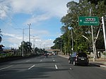
Elpidio Quirino Avenue

Streets in Metro Manila
4641Elpidio Quirino Avenue Parañaque City Landmarks 17

Elpidio Quirino Avenue, also known simply as Quirino Avenue, is a major north-south collector road in Parañaque, southern Metro Manila, Philippines. It is a four-lane undivided arterial running parallel to Roxas Boulevard and its extension, the Manila–Cavite Expressway, to the west from Baclaran at Parañaque's border with Pasay in the north to San Dionisio right by the border with Las Piñas in the south. It is a continuation of Harrison Avenue from Pasay and was originally a segment of the coastal highway called Calle Real. The entire road is a component of Radial Road 2 (R-2) of Manila's arterial road network, while its segment south of NAIA Road is a component of National Route 62 (N62) of the Philippine highway network. It was named after President Elpidio Quirino. The road's name is also applied alternatively to Diego Cera Avenue in Las Piñas.

Excerpt from the Wikipedia article Elpidio Quirino Avenue (License: CC BY-SA 3.0, Authors, Images).

Elpidio Quirino Avenue
Andres Bonifacio Street, Parañaque

Geographical coordinates (GPS) Address Nearby Places
placeShow on map

Wikipedia: Elpidio Quirino AvenueContinue reading on Wikipedia

Geographical coordinates (GPS)

Latitude Longitude
N 14.499444444444 ° E 120.99083333333 °
placeShow on map

Address

Andres Bonifacio Street 6896
1700 Parañaque
Philippines
mapOpen on Google Maps

4641Elpidio Quirino Avenue Parañaque City Landmarks 17
Share experience

Nearby Places

NAIA Road
NAIA Road

The NAIA Road (Ninoy Aquino International Airport Road), formerly known and still commonly referred to as the MIA Road (Manila International Airport Road), is a short 8-10 lane divided highway connecting Roxas Boulevard and the Manila–Cavite Expressway (R-1) with Ninoy Aquino International Airport (NAIA) in southwestern Metro Manila, Philippines. It is also a major local road that links the cities of Pasay and Parañaque running approximately 2.5 kilometers (1.6 mi) underneath the elevated NAIA Expressway from R-1 in Tambo, Parañaque to NAIA Terminal 2 in Pasay. En route, it intersects, from west to east, Quirino Avenue, Domestic Road, and Ninoy Aquino Avenue. The road ends at the entrance of NAIA Terminal 2. The road also houses a small strip of shops across from Coastal Mall, Tambo Elementary School at Quirino Avenue, Park 'N Fly at Domestic Road, and the old Nayong Pilipino close to Terminal 2. The old NAIA Terminal 1 is accessible by turning south at Ninoy Aquino Avenue, which also leads to the Duty Free FiestaMall and continues on to Sucat as Dr. Santos Avenue. The new Terminal 3, on the other hand, is located on Andrews Avenue which can be accessed from Domestic Road. The road was originally named as MIA Road and was only renamed in 1987 when Manila's international airport became Ninoy Aquino International, in honor of the late Senator Ninoy Aquino. The NAIA Expressway runs through the NAIA Road from the Sales Interchange of the Skyway to the junction of the NAIA Road and Macapagal Boulevard via Andrews Avenue and Electrical Road, providing better access to all four terminals of Ninoy Aquino International Airport, as well as the casino complex in Entertainment City.