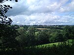
Black Brook, West Yorkshire
England river stubsRivers of CalderdaleUse British English from November 2016West Yorkshire geography stubs

The Black Brook is a small river in Calderdale, West Yorkshire, England. The Black Brook rises near the border of Calderdale and Kirklees next to Scammonden Dam. It flows downwards through Stainland Dean, and then between Greetland and Stainland. Most of the river, at this point, forms a parish border between the parishes of Greetland and Stainland. The Holywell Brook flows into the Black Brook before flowing into the River Calder at West Vale. The combined length of the two brooks is 8.85 miles (14.24 km) and they drain an area of 12 square miles (30 km2).The valley that the Black Brook flows through is named the Blackburne Valley.
Excerpt from the Wikipedia article Black Brook, West Yorkshire (License: CC BY-SA 3.0, Authors, Images).Black Brook, West Yorkshire
Berry Mill Lane, Calderdale Stainland & District
Geographical coordinates (GPS) Address Nearby Places Show on map
Geographical coordinates (GPS)
| Latitude | Longitude |
|---|---|
| N 53.661 ° | E -1.9 ° |
Address
Berry Mill Lane
Berry Mill Lane
HX4 9LQ Calderdale, Stainland & District
England, United Kingdom
Open on Google Maps


