Hastings Country Park

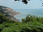
Hastings Country Park was formed in 1974 and covers 345 hectares (850 acres) east of Hastings in England. Sandstone cliffs, glens covered with gorse and trees, footpaths, nature trails, picnic areas and ample car parking are some of the features at the country park. Set in the High Weald Area of Outstanding Natural Beauty, it is also a Local Nature Reserve as Hastings Country Park & Fairlight Place Farm. An area of 184.5 hectares (456 acres) has been designated Hastings Cliffs Special Area of Conservation. Most of the park is in Hastings Cliffs to Pett Beach Site of Special Scientific Interest and it is also part of Hastings Cliffs Special Area of Conservation and Dungeness, Romney Marsh and Rye Bay Special Protection Area. Two areas in the park are Geological Conservation Review sites.
Excerpt from the Wikipedia article Hastings Country Park (License: CC BY-SA 3.0, Authors, Images).Hastings Country Park
Lower Coastguard Lane,
Geographical coordinates (GPS) Address Nearby Places Show on map
Geographical coordinates (GPS)
| Latitude | Longitude |
|---|---|
| N 50.871944444444 ° | E 0.63888888888889 ° |
Address
22
Lower Coastguard Lane
TN35 4AD
England, United Kingdom
Open on Google Maps


