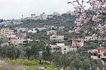
Alei Zahav
1983 establishments in the Palestinian territoriesIsraeli settlements in the West BankPalestine geography stubsPopulated places established in 1983Shomron Regional Council ... and 1 more
Wikipedia extended-confirmed-protected pages

Alei Zahav (Hebrew: עֲלֵי זָהָב, lit. Golden Leaves) is an Israeli settlement organized as a community settlement located on the western edge of the northern West Bank, adjacent to the Palestinian towns of Deir Ballut and Kafr ad-Dik, whose lands were confiscated for building Alei Zahav. The settlement, under the administrative municipal government of the Shomron Regional Council, is adjacent to Peduel and Beit Aryeh. In 2021 its population was 4,280. Israeli outposts are unauthorized in Israeli law, while Israeli settlements are considered illegal under international law, but the Israeli government disputes this.
Excerpt from the Wikipedia article Alei Zahav (License: CC BY-SA 3.0, Authors, Images).Alei Zahav
Bareket, Shomron Regional Council
Geographical coordinates (GPS) Address Nearby Places Show on map
Geographical coordinates (GPS)
| Latitude | Longitude |
|---|---|
| N 32.071666666667 ° | E 35.064166666667 ° |
Address
ברקת
Bareket
380 Shomron Regional Council
Judea and Samaria, Palestinian Territories
Open on Google Maps


