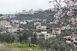
Beit Aryeh-Ofarim
1981 establishments in the Israeli Military GovernorateIsraeli settlements in the West BankLocal councils in IsraelPalestine geography stubsPopulated places established in 1981

Beit Aryeh-Ofarim (Hebrew: בֵּית אַרְיֵה-עֳפָרִים) is an Israeli settlement and local council in the northern West Bank. It is located 32 kilometers (20 mi) north of Jerusalem and 25 kilometers (16 mi) east of Tel Aviv, near the Palestinian village of al-Lubban al-Gharbi, 3.8 km kilometers east of the Green line. It is situated on the Palestinian side of the Israeli West Bank barrier, on 8,500 dunams of land. In 2021 it had a population of 5,409. Israeli settlements in the West Bank are considered illegal under international law, but the Israeli government disputes this.
Excerpt from the Wikipedia article Beit Aryeh-Ofarim (License: CC BY-SA 3.0, Authors, Images).Beit Aryeh-Ofarim
כביש המערכת בית אריה,
Geographical coordinates (GPS) Address Nearby Places Show on map
Geographical coordinates (GPS)
| Latitude | Longitude |
|---|---|
| N 32.035497222222 ° | E 35.0538 ° |
Address
כביש המערכת בית אריה
כביש המערכת בית אריה
Judea and Samaria, Palestinian Territories
Open on Google Maps


