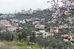
Leshem (Israeli settlement)

Leshem (Hebrew: לֶשֶם) is a religious Israeli unauthorized settlement in the West Bank. It is located on Route 446, about 13 km (8 miles) west of the Palestinian city of Salfit and about 37 km (23 miles) northwest of Jerusalem, in the Palestinian side of the Israeli West Bank barrier. Leshem is neighbored by the Israeli settlements of Alei Zahav (of which Leshem is officially "a neighborhood"), Peduel, Bruchin, Beit Aryeh-Ofarim, the archeological site of Deir Samaan, and the Palestinian villages Rafat, Kafr ad-Dik, and Deir Ballut. Leshem settlement rises to a height of 360 meters (1181.1 feet) above sea level and is stretched across two hills, the eastern hill and the western hill which altogether cover about 497 dunam (122.811 acres).The international community considers Israeli settlements in the West Bank illegal under international law, but the Israeli government dispute this.
Excerpt from the Wikipedia article Leshem (Israeli settlement) (License: CC BY-SA 3.0, Authors, Images).Leshem (Israeli settlement)
Tamar, Shomron Regional Council
Geographical coordinates (GPS) Address Nearby Places Show on map
Geographical coordinates (GPS)
| Latitude | Longitude |
|---|---|
| N 32.069722222222 ° | E 35.051111111111 ° |
Address
תמר
Tamar
380 Shomron Regional Council
Judea and Samaria, Palestinian Territories
Open on Google Maps


