place

Dry Creek explosives depot

2 ft 6 in gauge railways in AustraliaBuildings and structures in AdelaideExplosivesMagazines (artillery)Ports and harbours of South Australia
Railway lines in South AustraliaSouth Australian Heritage RegisterUse Australian English from March 2015
Powder magazines at Dry Creek, State Library of South Australia B 22286

The Dry Creek explosives depot was a secure storage facility near Port Adelaide from 1906 to 1995, serving the construction, mining and quarrying industries of South Australia, as well as the mines of Broken Hill in New South Wales.

Excerpt from the Wikipedia article Dry Creek explosives depot (License: CC BY-SA 3.0, Authors, Images).

Dry Creek explosives depot
Cavan Road, Adelaide Dry Creek

Geographical coordinates (GPS) Address Website Nearby Places
placeShow on map

Wikipedia: Dry Creek explosives depotContinue reading on Wikipedia

Geographical coordinates (GPS)

Latitude Longitude
N -34.828347 ° E 138.57998 °
placeShow on map

Address

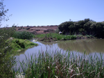
Greenfields Wetlands

Cavan Road
5094 Adelaide, Dry Creek
South Australia, Australia
mapOpen on Google Maps

Website
salisbury.sa.gov.au

linkVisit website

Powder magazines at Dry Creek, State Library of South Australia B 22286
Share experience

Nearby Places

Salisbury Highway

The Salisbury Highway (part of Route A9, previously Route A13 / National Highway A13) is a 12 kilometre major connecting road in the northern suburbs of the Adelaide metropolitan area. Salisbury Highway is dual carriageway in its entirety. It starts as Route A9 (formerly A13 until May 2017) in Elizabeth Vale as John Rice Avenue. Past the suburb of Salisbury it takes on its Salisbury Highway name. It then runs parallel to Main North Road (Route A20) and crosses over Kings Road (Route A18). At Port Wakefield Road (National Highway A1), it previously changed status to National Highway A13 (now A9 right through) before ending at the intersection of the Port River Expressway and South Road. Route A9 continues along Port River Expressway. Prior to 2017, National Highway A13 then followed South Road to Grand Junction Road (Route A16 / National Highway A16), where it changed status back to Route A13 and continued south along South Road, Main South Road and Victor Harbor Road, terminating at Victor Harbor on the south coast. The North–South Motorway is designated Route M2, and South Road continuing from it was converted to route A2 in May 2017. Salisbury Highway was shown as part of the National Highway A13 between the Port Wakefield Road and the Port River Expressway on local road signage and major street directory publications.Until the early 1990s, Salisbury Highway terminated at Port Wakefield Road. The Salisbury Highway Extension project built the bridge and interchange at Port Wakefield Road, and extended the highway to Wingfield, where it joined the north end of what was then the South Road Interconnector. Neither the Port River Expressway nor the North–South Motorway had been built at that time.

Gepps Cross, South Australia

Gepps Cross (pronounced 'Jepps Cross') is a suburb and major road intersection in the north of Adelaide, South Australia. Gepps Cross is traditionally seen as the end of the inner suburbs and the start of the outer northern suburbs, as it was home to a major abattoir (now closed and demolished) with holding yards and other open space. It is the first significant open space encountered after the North Parklands. It retains the open nature, even with warehouses, a velodrome, hockey stadium, Adelaide Raiders – a Croatian soccer club, and karate training facilities. Gepps Cross is best known for the five-way intersection with Grand Junction Road going east and west, Main North Road south and north-east, and Port Wakefield Road going north. The intersection is not grade-separated. It is controlled by traffic lights, and all five roads have at least three lanes in each direction. These roads include the main highways from Adelaide to Western Australia and the Northern Territory (via Port Wakefield Road), New South Wales (via Main North Road), the northern suburbs of Adelaide and the northern parts of South Australia (both roads). Port Adelaide is to the west, and the major freight hubs are northwest of Gepps Cross. A major route from Port Adelaide towards Victoria and the south and east of South Australia is east along Grand Junction Road then south along Portrush Road to the South Eastern Freeway. It was a holding place for people that came from England in 1952; from there they went interstate to find new homes.