place

Sugar Quay

City of London
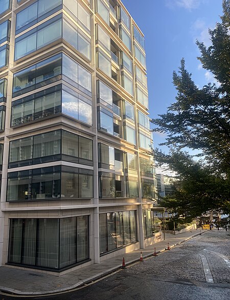
Sugar Quay 2021
Sugar Quay 2021

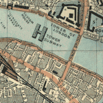
Sugar Quay is a quay alongside the Thames in the City of London, London, England.

Excerpt from the Wikipedia article Sugar Quay (License: CC BY-SA 3.0, Authors, Images).

Sugar Quay
Water Lane, City of London

Geographical coordinates (GPS) Address Nearby Places
placeShow on map

Wikipedia: Sugar QuayContinue reading on Wikipedia

Geographical coordinates (GPS)

Latitude Longitude
N 51.50827 ° E -0.08086 °
placeShow on map

Address

Landmark Place

Water Lane
EC3R 6AP City of London
England, United Kingdom
mapOpen on Google Maps

Sugar Quay 2021
Sugar Quay 2021
Share experience

Nearby Places

Worshipful Company of Bakers

The Worshipful Company of Bakers is one of the Livery Companies of the City of London. The Bakers' Guild is known to have existed in the twelfth century. From the Corporation of London, the Guild received the power to enforce regulations for baking, known as the Assize of Bread and Ale. The violations included selling short-weight bread and the addition of sand instead of flour. The Bread Assize remained in force until 1863, when Parliament repealed it. In the 14th century, the Guild divided into the Brown-Bakers' Guild and the White-Bakers' Guild. The Brown-Bakers were bakers of nutritious bread, while the White-Bakers were bakers of the less nutritious but more popular bread. The White-Bakers were incorporated by a Royal Charter of 1509, while the Brown-Bakers were incorporated in 1621. The White and Brown Bakers united into one Company in 1645. The new Company acquired a new Charter in 1686, under which it still operates. Bakers Hall in Harp Lane, Billingsgate, has been the site of the Guildhall of the bakers since 1506. It contains a courtroom where trade-related misdemeanours could be tried. There are many such associated trades guilds, such as the Incorporation of Bakers, one of the fourteen Incorporated Trades of Glasgow, who meet in their Robert Adam designed Trades Hall. In the medieval town of Orvieto, bakers were one of the thirty-one organized crafts. Now largely ceremonial and charitable, these crafts and guilds formerly fulfilled the role of regulation much of which is now covered by local government. The Bakers' Company ranks nineteenth in the order of precedence of Livery Companies. The company's motto is Praise God For All.

Malta George Cross Memorial

The Malta George Cross Memorial, also known as the Maltese Memorial, is a war memorial in London, built to commemorate the Siege of Malta in the Second World War, which led to the island's being collectively awarded the George Cross in April 1942. The memorial was unveiled in 2005, near All Hallows by the Tower. The memorial is constructed from a large rectangular monolithic block of limestone from the Maltese island of Gozo. The block stands 3 metres (9.8 ft) high and weighs 8.5 tons. It bears an inscribed black slate panel on each of its four sides. The main panel to the southeast recounts the Siege of Malta from 1940 to 1943, and the consequent loss of 7,000 lives of Maltese civilians and Allied and Commonwealth service personnel. A Maltese cross is displayed above this main panel. Further details of the siege are inscribed on a second panel on the northwest face of the memorial. The panel to the northeast gives details of the award of the George Cross, and the panel to the southwest has a map illustrating the Allied operations in the Mediterranean Sea. The stone was presented by the Government of Malta and erected by the George Cross Island Association in 2005, for the 60th anniversary of the end of the Second World War. It was unveiled on 15 August 2005 by the President of Malta Eddie Fenech Adami, and dedicated by Vincent Nichols, then the Roman Catholic Archbishop of Birmingham, with a wreath laid by Prince Philip, Duke of Edinburgh. The date was the 63rd anniversary of the arrival of the last surviving ship of the Operation Pedestal convoy at Valletta Grand Harbour that provided critical supplies during the siege. The unveiling was attended by approximately 100 veterans of the Malta campaign, and representatives of Allied and Commonwealth forces. The stone was a bright white colour when it was unveiled, but has been weathered and darkened. There is a further memorial to the George Cross Island Association at the National Memorial Arboretum at Alrewas near Lichfield, and one in the Peace Garden of the former Anglican Church of St Luke, Liverpool.

HMS Belfast
HMS Belfast

HMS Belfast is a Town-class light cruiser that was built for the Royal Navy. She is now permanently moored as a museum ship on the River Thames in London and is operated by the Imperial War Museum. Construction of Belfast, the first ship in the Royal Navy to be named after the capital city of Northern Ireland and one of ten Town-class cruisers, began in December 1936. She was launched on St Patrick's Day 1938. Commissioned in early August 1939 shortly before the outbreak of the Second World War, Belfast was initially part of the British naval blockade against Germany. In November 1939, Belfast struck a German mine and, in spite of fears that she would be scrapped, spent more than two years undergoing extensive repairs. Belfast returned to action in November 1942 with improved firepower, radar equipment, and armour. Belfast saw action escorting Arctic convoys to the Soviet Union during 1943 and in December 1943 played an important role in the Battle of North Cape, assisting in the destruction of the German warship Scharnhorst. In June 1944, Belfast took part in Operation Overlord supporting the Normandy landings. In June 1945, she was redeployed to the Far East to join the British Pacific Fleet, arriving shortly before the end of the Second World War. Belfast saw further combat action in 1950–52 during the Korean War and underwent an extensive modernisation between 1956 and 1959. A number of further overseas commissions followed before she entered reserve in 1963. In 1967, efforts were initiated to avert Belfast's expected scrapping and to preserve her as a museum ship. A joint committee of the Imperial War Museum, the National Maritime Museum, and the Ministry of Defence was established and then reported in June 1968 that preservation was practical. In 1971, however, the government decided against preservation, prompting the formation of the private HMS Belfast Trust to campaign for her preservation. The efforts of the Trust were successful, and the government transferred the ship to the Trust in July 1971. Brought to London, she was moored on the River Thames near Tower Bridge in the Pool of London. Opened to the public in October 1971, Belfast became a branch of the Imperial War Museum in 1978. A popular tourist attraction, Belfast received over 327,000 visitors in 2019. As a branch of a national museum and part of the National Historic Fleet, Belfast is supported by the Department for Culture, Media and Sport, admissions income, and the museum's commercial activities.
Great Tower Street
Great Tower Street

Great Tower Street, originally known just as Tower Street, is a street in the City of London, the historic nucleus and modern financial centre of London. It forms an eastern continuation of Eastcheap starting at Idol Lane, and leads towards Byward Street and Tower Hill. On Byward Street, opposite Great Tower Street, is the historic church All Hallows-by-the-Tower. A public house called the Czar's Head used to stand at No. 48, so named because Peter the Great used to drink there when he was learning shipbuilding at Deptford. Somewhere on Tower Street in 1688, Edward Lloyd opened Lloyd's Coffee House, where the insurance market Lloyd's of London originated. In 1691, Lloyd relocated his shop to nearby Lombard Street; today Lloyd's is based on Lime Street. Prior to boundary changes in 2003, Great Tower Street formed the centre of the City ward of Tower. Today it lies mostly in Billingsgate ward, but a short portion of the easternmost end of the street is still within Tower ward. Great Tower Street is home to a number of restaurants and offices, including the southern entrance to the London Underwriting Centre at the corner with Mincing Lane, and Plantation Place South. It formed part of the marathon course of the 2012 Olympic and Paralympic Games. The women's Olympic marathon took place on 5 August and the men's on 12 August. The Paralympic marathons were held on 9 September.The nearest London Underground stations are Monument and Tower Hill and the closest mainline railway station is Fenchurch Street.

London Wall
London Wall

The London Wall was a defensive wall first built by the Romans around the strategically important port town of Londinium in c. AD 200. It has origins as an initial mound wall and ditch from c. AD 100 and an initial fort, now called Cripplegate fort after the city gate (Cripplegate) that was positioned within its northern wall later on, built in 120-150 where it was then expanded upon by Roman builders into a city-wide defence. Over time, as Roman influence waned through the departure of the Roman army in c. 410, their withdrawal led to its disrepair, as political power on the island dispersed through the Heptarchy (seven kingdoms) period of Anglo-Saxon England. From the conquest of William the Conqueror, successive medieval restorations and repairs to its use have been undertaken. This wall largely defined the boundaries of the City of London until the later Middle Ages, when population rises and the development of towns around the city blurred the perimeter.Events such as the Wars of the Roses also played a part in the wall's development. This can be seen upon fragments of wall in the distinctive bricks used to increase its height through the diaper pattern bricks characteristic of the Tudor period and added crenellated battlements. Throughout its existence, the wall has served multiple purposes such as fortification, controlling the population, and acting as a ceremonial boundary for the city. From the 18th century onward, the expansion of the City of London saw large parts of the wall demolished, including its city gates, to improve traffic flow; or incorporated into new or existing buildings. Over time, parts of the wall have been lost through this development, although archeological and conservation efforts from the Second World War onward have helped to preserve sections of the city wall as scheduled monuments. Like most other city walls around England, and unlike rare examples such as York, the London Wall largely no longer exists, most of its foundations and/or surviving structures having been either buried underground or removed. Its existence, though, can still be seen through a number of uncovered and/ or preserved structures, records (see interactive map), and within modern urban architecture like the London Wall Road that echos the perimeter of the northern section of the London Wall. See source Wikidata query. See this map in big, interactive, with illustrations and more