place

Cooleys Corner, New Jersey

Monmouth County, New Jersey geography stubsUnincorporated communities in Monmouth County, New JerseyUnincorporated communities in New JerseyUpper Freehold Township, New JerseyUse American English from July 2023
Use mdy dates from July 2023
Cooleys Corner, NJ
Cooleys Corner, NJ

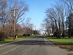
Cooleys Corner is an unincorporated community located within Upper Freehold Township in Monmouth County, in the U.S. state of New Jersey. The site of the settlement is within the Assunpink Wildlife Management Area, a New Jersey Department of Environmental Protection Division of Fish and Wildlife-operated preserved area in Monmouth and Mercer counties along the Assunpink Creek. Before the creation of the Assunpink Lake in the 1970s, the area consisted of farmland located at the intersection of Clarksburg Road and Imlaystown-Hightstown Road. Some farmland is still present in the area but is now mostly used by hunters. The main boat ramp to Assunpink Lake is located along the former Imlaystown-Hightstown Road.

Excerpt from the Wikipedia article Cooleys Corner, New Jersey (License: CC BY-SA 3.0, Authors, Images).

Cooleys Corner, New Jersey
Clarksburg-Robbinsville Road,

Geographical coordinates (GPS) Address Nearby Places
placeShow on map

Wikipedia: Cooleys Corner, New JerseyContinue reading on Wikipedia

Geographical coordinates (GPS)

Latitude Longitude
N 40.214722222222 ° E -74.516388888889 °
placeShow on map

Address

Clarksburg-Robbinsville Road 698
08691
New Jersey, United States
mapOpen on Google Maps

Cooleys Corner, NJ
Cooleys Corner, NJ
Share experience

Nearby Places

Roosevelt Public School District

The Roosevelt Public School District is a community public school district that serves students in pre-kindergarten through fifth grade from Roosevelt in Monmouth County, in the U.S. state of New Jersey.As of the 2021–22 school year, the district, comprised of one school, had an enrollment of 84 students and 8.0 classroom teachers (on an FTE basis), for a student–teacher ratio of 10.5:1. In the 2016–17 school year, Roosevelt had the 6th-smallest enrollment of any school district in the state, with 88 students.The district is classified by the New Jersey Department of Education as being in District Factor Group "GH", the third-highest of eight groupings. District Factor Groups organize districts statewide to allow comparison by common socioeconomic characteristics of the local districts. From lowest socioeconomic status to highest, the categories are A, B, CD, DE, FG, GH, I and J.For sixth through twelfth grades, public school students attend the East Windsor Regional School District, which serves students from East Windsor Township and Hightstown Borough, with students from Roosevelt attending as part of a sending/receiving relationship. Schools in the East Windsor district attended by Roosevelt students (with 2021–22 enrollment data from the National Center for Education Statistics) are Melvin H. Kreps Middle School with 1,194 students in grades 6–8 and Hightstown High School with 1,621 students in grades 9–12.

East Windsor, New Jersey

East Windsor is a township in Mercer County, in the U.S. state of New Jersey. Located at the cross-roads between the Delaware Valley region to the southwest and the Raritan Valley region to the northeast, the township is an outer-ring suburb of New York City in the New York Metropolitan area, as defined by the United States Census Bureau, but directly borders the Philadelphia metropolitan area and is part of the Federal Communications Commission's Philadelphia Designated Market Area. Since East Windsor is situated at the confluence of several major highways that serve both the major cities of New York City and Philadelphia, and even the local commercial hubs of nearby Freehold, Princeton, and the state capital of Trenton, the community has been a longtime residential, commercial, and industrial hub in the heart of Central New Jersey.As of the 2020 United States census, East Windsor's population was 30,045, its highest decennial count ever and an increase of 2,855 (+10.5%) from the 27,190 recorded at the 2010 census, which in turn reflected an increase of 2,271 (+9.1%) from the 24,919 counted in the 2000 census.Both East Windsor and West Windsor were formed when Windsor Township was split on February 9, 1797, while the area was still part of Middlesex County. It was incorporated by an act of the New Jersey Legislature on February 21, 1798, as one of New Jersey's initial group of 104 townships. Portions of the township were taken to form Hightstown borough (March 5, 1853, within East Windsor; became independent c. 1894) and Washington Township (March 11, 1860, and known as Robbinsville Township since 2007). The township was named for Windsor Township, which was named for Windsor, England.