place

Bergerville, New Jersey

Monmouth County, New Jersey geography stubsNeighborhoods in Howell Township, New JerseyUnincorporated communities in Monmouth County, New JerseyUnincorporated communities in New JerseyUse American English from July 2023
Use mdy dates from July 2023
Bergerville, NJ
Bergerville, NJ

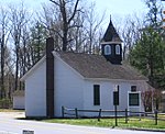
Bergerville is an unincorporated community located within Howell Township in Monmouth County, in the U.S. state of New Jersey. The area was originally developed as a resort bungalow community in the first half of the 20th century.The settlement is centered on the intersection of U.S. Route 9 (which runs north and south), Bergerville Road (which runs west towards Freehold Township) and Casino Drive (which runs east towards the Manasquan Reservoir). Commercial businesses line US 9 through the area and some single-family houses are located along the two main east–west roads and Fort Plains Road. Numerous condominium and town house developments are also located nearby.

Excerpt from the Wikipedia article Bergerville, New Jersey (License: CC BY-SA 3.0, Authors, Images).

Bergerville, New Jersey
Brookview Court,

Geographical coordinates (GPS) Address Nearby Places
placeShow on map

Wikipedia: Bergerville, New JerseyContinue reading on Wikipedia

Geographical coordinates (GPS)

Latitude Longitude
N 40.201944444444 ° E -74.261666666667 °
placeShow on map

Address

Brookview Court 464
07731
New Jersey, United States
mapOpen on Google Maps

Bergerville, NJ
Bergerville, NJ
Share experience

Nearby Places

Freehold Township, New Jersey

Freehold Township is a township in western Monmouth County, in the U.S. state of New Jersey. Crisscrossed by several major highways, the township is a commercial hub for Central New Jersey (home to the Freehold Raceway and Freehold Raceway Mall) and is a suburban bedroom community of New York City, located within the Raritan Valley region of the much larger New York Metropolitan Area. The township is located roughly 38 miles (61 km) away from Manhattan and about 20 miles (32 km) away from Staten Island. As of the 2020 United States census, the township's population was 35,369, a decrease of 815 (−2.3%) from the 36,184 recorded at the 2010 census, which in turn had reflected an increase of 4,647 (+14.7%) from the 31,537 counted at the 2000 census.Freehold Township was first formed on October 31, 1693, and was incorporated as a township by an act of the New Jersey Legislature on February 21, 1798. Portions of Freehold Township were taken to form Upper Freehold Township (c. 1731), so some wills and official records following the split referred to "Lower Freehold Township" although the official name has always been Freehold Township. Additional portions formed Millstone Township (February 28, 1844), Jackson Township (March 6, 1844), Atlantic Township (February 18, 1847; now Colts Neck Township), Marlboro Township (February 17, 1848) and Manalapan Township (March 9, 1848). Freehold town was formed within the township on March 25, 1869, and formally separated when it was reconstituted as a borough on April 15, 1919, including additional portions of the township.The Battle of Monmouth was fought in June 1778 in what has been preserved as Monmouth Battlefield State Park, which is in Freehold Township and Manalapan Township.