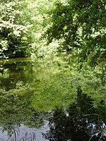
Palmarsh
Hamlets in KentKent geography stubs
Palmarsh is a community (OS grid reference TR1333) in Folkestone and Hythe district, in the County of Kent, England. In origin it was a hamlet on the edge of the Romney Marsh, but modern development to the west of Hythe (mostly housing, together with some local shops) in a corridor along the A259 coastal road, has led to the joining together of the ancient town and cinque port of Hythe (to the east) and the rural hamlet of Palmarsh (to the west) in a single conurbation.
Excerpt from the Wikipedia article Palmarsh (License: CC BY-SA 3.0, Authors).Palmarsh
St. Georges Place, Folkestone and Hythe District Palmarsh
Geographical coordinates (GPS) Address Phone number Website Nearby Places Show on map
Geographical coordinates (GPS)
| Latitude | Longitude |
|---|---|
| N 51.063 ° | E 1.048 ° |
Address
Palmarsh Primary School
St. Georges Place
CT21 6NE Folkestone and Hythe District, Palmarsh
England, United Kingdom
Open on Google Maps


