place

Thornborough Bridge

Bridges in BuckinghamshireBuckinghamshire building and structure stubsGrade I listed buildings in BuckinghamshireScheduled monuments in BuckinghamshireUnited Kingdom bridge (structure) stubs
Use British English from September 2017
Thornborough Bridge
Thornborough Bridge

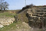
Thornborough Bridge is located on the original Bletchley and Buckingham road, now bypassed by a modern bridge in 1974 for the A421. The bridge is accessible to walkers from an adjacent lay-by. The bridge straddles the parish boundaries of Thornborough and Buckingham (the parish boundary follows the line of Padbury Brook or The Twins, a tributary of the River Great Ouse), and dates from the end of the 14th century and is the only surviving mediaeval bridge in Buckinghamshire. The parish division is marked by a boundary stone in the middle of the bridge.The stone bridge is around 30 m (98 ft) long and 4 m (13 ft) wide, and spans the river by six low arches, with three refuges formed within the parapet on the south side. The bridge is Grade I listed by English Heritage.

Excerpt from the Wikipedia article Thornborough Bridge (License: CC BY-SA 3.0, Authors, Images).

Thornborough Bridge
A421,

Geographical coordinates (GPS) Address Nearby Places
placeShow on map

Wikipedia: Thornborough BridgeContinue reading on Wikipedia

Geographical coordinates (GPS)

Latitude Longitude
N 51.99248 ° E -0.93935 °
placeShow on map

Address

A421
MK18 7DX
England, United Kingdom
mapOpen on Google Maps

Thornborough Bridge
Thornborough Bridge
Share experience

Nearby Places

Adstock
Adstock

For the municipality in Quebec, see Adstock, Quebec Adstock is a village and civil parish about 2.5 miles (4.0 km) northwest of Winslow and 3 miles (4.8 km) southeast of Buckingham in the Aylesbury Vale district of Buckinghamshire. The 2001 Census recorded a parish population of 415 reducing to 363 at the 2011 Census.There are remains of a Roman road in the village. In the divisions of England that took place between AD 613 and 1017, Buckinghamshire was divided into eight hundreds. The manor of Adstock originally formed part of the Votesdune Hundred, then merged into the Ashendon Hundred and was finally absorbed into the Buckingham Hundred. At that time it was surrounded by the Bernwood, one of the most important Royal Forests. At the end of the 10th century, Adstock formed a portion of the Lands of Godwine, Earl of Kent and his second wife Gytha Thorkelsdóttir. After the Norman conquest of England, its name was recorded in the Domesday Book of 1086 as Edestoche which is Old English and means Eadda's Farm. Nearby Addington was named after the same person. In the mid to late 11th century the manor of Adstock was given by William the Conqueror to his illegitimate son William Peverel, who was listed as its owner in 1086. This suggests that the manor was of some value, or that its previous owner was of some prominence in Anglo Saxon society. The village received a charter to establish itself as a town briefly in 1665 so that a market could be held there. This was due to the majority of the people from the two local towns of Winslow and Buckingham being infected with bubonic plague. The charter was removed, however, in 1685 and Adstock was reinstated as a village rather than a town. The parish church, which dates from the 12th century, is dedicated to St Cecilia. The roof is dated 1597, and the church underwent further major restoration during the Victorian era. There are two bells (the lightest of which dates back from about 1440) in the church and one Sanctus Adstock had an outstation from the Bletchley Park codebreaking establishment, where some of the Bombes used to decode German Enigma messages in World War Two were located.