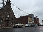
Top Road, Trenton, New Jersey
Mercer County, New Jersey geography stubsNeighborhoods in Trenton, New JerseyTrenton, New Jersey stubsUse American English from July 2023Use mdy dates from July 2023

Top Road is a neighborhood located within the city of Trenton in Mercer County, in the U.S. state of New Jersey. Much of Top Road was once part of Lawrence Township and then was added to the now-defunct Millham Township before being annexed by Trenton in 1888.
Excerpt from the Wikipedia article Top Road, Trenton, New Jersey (License: CC BY-SA 3.0, Authors, Images).Top Road, Trenton, New Jersey
Mulberry Street, Trenton
Geographical coordinates (GPS) Address Nearby Places Show on map
Geographical coordinates (GPS)
| Latitude | Longitude |
|---|---|
| N 40.240555555556 ° | E -74.743888888889 ° |
Address
Mulberry Street 624
08638 Trenton
New Jersey, United States
Open on Google Maps


