Abbotswood, Hampshire
Hampshire geography stubsRomseyUse British English from December 2015Villages in Hampshire

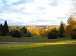
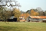
Abbotswood is a new 52-hectare building development planned to have 800 homes. It is located just to the north east of the town of Romsey in the Test Valley local government district.
Excerpt from the Wikipedia article Abbotswood, Hampshire (License: CC BY-SA 3.0, Authors, Images).Abbotswood, Hampshire
Ambrose Way, Test Valley Abbotswood
Geographical coordinates (GPS) Address Nearby Places Show on map
Geographical coordinates (GPS)
| Latitude | Longitude |
|---|---|
| N 51.006026 ° | E -1.477575 ° |
Address
Ambrose Way 43
SO51 0BF Test Valley, Abbotswood
England, United Kingdom
Open on Google Maps


