Test Valley
Andover, HampshireBoroughs in EnglandNon-metropolitan districts of HampshirePages with non-numeric formatnum argumentsTest Valley

Test Valley is a local government district and borough in Hampshire, England, named after the valley of the River Test. Its council is based in Andover. The borough was formed on 1 April 1974 by a merger of the boroughs of Andover and Romsey, along with Andover Rural District and Romsey and Stockbridge Rural District.
Excerpt from the Wikipedia article Test Valley (License: CC BY-SA 3.0, Authors, Images).Test Valley
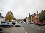
Longstock Road, Test Valley
Geographical coordinates (GPS) Address Nearby Places Show on map
Geographical coordinates (GPS)
| Latitude | Longitude |
|---|---|
| N 51.1394 ° | E -1.491 ° |
Address
Longstock Road
Longstock Road
SO20 6EB Test Valley
England, United Kingdom
Open on Google Maps


