East Hampshire
East Hampshire DistrictNon-metropolitan districts of HampshirePages with non-numeric formatnum arguments

East Hampshire is a local government district in Hampshire, England. Its council is based in the town of Petersfield, although the largest town is Alton. The district also contains the town of Bordon along with many villages and surrounding rural areas. Parts of the district lie within the South Downs National Park. The neighbouring districts are Havant, Winchester, Basingstoke and Deane, Hart, Waverley and Chichester.
Excerpt from the Wikipedia article East Hampshire (License: CC BY-SA 3.0, Authors, Images).East Hampshire
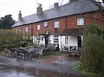
Penns Place, East Hampshire
Geographical coordinates (GPS) Address Nearby Places Show on map
Geographical coordinates (GPS)
| Latitude | Longitude |
|---|---|
| N 51.0055 ° | E -0.9082 ° |
Address
Penns Place
GU31 4EP East Hampshire
England, United Kingdom
Open on Google Maps


