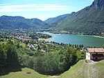
Palvico
Italy river stubsRivers of ItalyRivers of Trentino

The Palvico (it. Torrente Palvico) is an emissary of the lake Lago d'Ampola. Between Tiarno di Sopra and Storo the river flows inside a deep cut canyon through various basins with steps up to 20 m in between. The last bassin opens with a 50 m drop called Buco della Morte (en: Mouth of death) to the valley at Storo. This potential has been used since 1905 for hydroelectric plants.
Excerpt from the Wikipedia article Palvico (License: CC BY-SA 3.0, Authors, Images).Palvico
Sentiero Alpinistico, Comunità montana della Valle Sabbia
Geographical coordinates (GPS) Address Nearby Places Show on map
Geographical coordinates (GPS)
| Latitude | Longitude |
|---|---|
| N 45.816666666667 ° | E 10.416666666667 ° |
Address
Sentiero Alpinistico
Sentiero Alpinistico
25060 Comunità montana della Valle Sabbia
Lombardy, Italy
Open on Google Maps


