place

Brynmawr railway station

1862 establishments in Wales1963 disestablishments in WalesDisused railway stations in Blaenau GwentFormer London and North Western Railway stationsPages with no open date in Infobox station
Railway stations in Great Britain closed in 1962Railway stations in Great Britain opened in 1862Use British English from January 2017
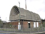
Brynmawr station, with local train from Newport geograph 2574136 by Ben Brooksbank

Brynmawr railway station was a station which served Nantyglo and Brynmawr in the Welsh county of Brecknockshire.

Excerpt from the Wikipedia article Brynmawr railway station (License: CC BY-SA 3.0, Authors, Images).

Brynmawr railway station
Barley Field Road,

Geographical coordinates (GPS) Address Phone number Nearby Places
placeShow on map

Wikipedia: Brynmawr railway stationContinue reading on Wikipedia

Geographical coordinates (GPS)

Latitude Longitude
N 51.7964 ° E -3.173 °
placeShow on map

Address

Blaen-Y-Cwm C.P. School (Blaenycwm County Primary School)

Barley Field Road
NP23 4BR , Twyn Cynhordy
Wales, United Kingdom
mapOpen on Google Maps

Phone number

call+441495313524

Brynmawr station, with local train from Newport geograph 2574136 by Ben Brooksbank
Share experience

Nearby Places

Brynmawr rubber factory

The Brynmawr rubber factory is a now-demolished building which was situated in Brynmawr in Blaenau Gwent, Wales. It was designed and constructed between 1946 and 1952 by the Architects' Co-Partnership, a group of architecture alumni from the Architectural Association in London, in collaboration with engineer Ove Arup. Featuring a nine-domed concrete ceiling, the building was part of the "Festival of Britain period" in architecture and became the first post-war building to receive listed status, with a Grade-II* designation in 1986. Despite this status, the building was demolished in 2001 leaving only the boiler house intact, and the site is now occupied by housing and a superstore. The building was commissioned by the industrialist Lord James Forrester for Enfield Cables, of which he was a director. Forrester had been part of the pre-war Brynmawr Experiment, which aimed to revive the town following the Great Depression. His desire for regeneration led to his decision to situate the factory in Brynmawr, despite it not being the best location commercially. Enfield Cables were not able to make the site economically viable after opening, and it was taken over by the Dunlop Rubber Company, operating under the brand name Dunlop Semtex. Dunlop Semtex achieved success with the factory, producing flooring for the health and education sectors, going on to buy the site in 1964. A downturn in fortunes in the late 1970s and early 1980s led to the factory's closure in 1981.

Mynydd Llangatwg
Mynydd Llangatwg

Mynydd Llangatwg or Llangattock Mountain is a hill in the Brecon Beacons National Park in the county of Powys, south Wales. It is named from the village of Llangatwg (or 'Llangattock') which sits in the valley of the River Usk to the north of it. It is essentially an undulating plateau rising in the west to a height of 530 metres (1,740 ft) at grid reference SO171157 and in the east to a height of 529 metres (1,736 ft) at Hen Dy-aderyn / Twr Pen-cyrn. This spot is marked by a trig point. The shallow pool of Pwll Gwy-rhoc sits in a broad depression towards the northern edge of the plateau whilst a smaller pool frequently occupies a large shakehole a few hundred metres to its west. The hill forms an impressive northern scarp overlooking the Usk valley and commonly referred to as the Llangattock Escarpment. Its southern margins are more subdued. Its eastern end is defined by the drops into the Clydach Gorge. Beyond the B4560 to the west the hill merges with Mynydd Llangynidr which has a similar character. Particular features of note include 'The Lonely Shepherd', an isolated limestone pinnacle which stands at the eastern tip of the plateau, left there by quarryworkers who removed great quantities of the surrounding rock. A number of cairns are scattered across the hill, notably the sizeable pair which decorate the summit of Twr Pen-cyrn and which are thought to be of Neolithic age. Some freshwater ponds litter the mountain, including Pwll Gwy-rhoc the "witches pool". A more recent addition to the landscape was Cairn-Mound Reservoir which once impounded the headwaters of Nant yr Hafod on the southern slopes though Welsh Water abandoned this some years ago and its bed has revegetated, though the embankment remains. A couple of gas pipelines have been laid across the mountain and their courses can be traced variously by fences, vegetation changes and marker poles.