Plungar
Commons category link is locally definedFormer civil parishes in LeicestershireOil fields of EnglandRedmileUse British English from December 2014 ... and 1 more
Villages in Leicestershire

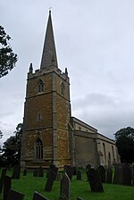
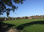
Plungar is a village and former civil parish, now in the parish of Redmile, and the Melton district of Leicestershire, England. It is about 9 miles (14 km) north of the market town of Melton Mowbray and 7 miles (11 km) west from Grantham. Plungar is adjacent to the Grantham Canal and stands in the Vale of Belvoir. In 1931 the parish had a population of 205.
Excerpt from the Wikipedia article Plungar (License: CC BY-SA 3.0, Authors, Images).Plungar
Harby Lane, Melton Redmile
Geographical coordinates (GPS) Address Nearby Places Show on map
Geographical coordinates (GPS)
| Latitude | Longitude |
|---|---|
| N 52.8966 ° | E -0.85887 ° |
Address
Harby Lane
Harby Lane
NG13 0JG Melton, Redmile
England, United Kingdom
Open on Google Maps


