Friars Oak Fields
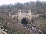
Friars Oak Fields are now being built over, but they were a much loved local landmark on the north-western edge of the village of Hassocks, in the county of West Sussex, England. They were a group of three small wealden meadows in their natural state, divided by ancient hedgerows. The railway and the Herring Stream served to isolate the eastern and western boundaries of Friars Oak Fields, which created a largely undisturbed environment favourable for wildlife. The Friars Oak Inn, an old coaching stop where horses were changed, was immediately adjacent to the Fields, on the western side. The western boundary of the fields was demarcated by the "Herring Stream" and the fields served as a flood plain for the stream. The eastern boundary of the fields was demarcated by a high raised embankment carrying the Brighton Main Line railway. The northern boundary of Friars Oak Fields met agricultural countryside. Access points to Friars Oak Fields were all located at the southern boundary. in 2019, Developer Rydon Homes has since been granted planning permission for 130 plus residential homes for the land at north of Shepherds Walk, Hassocks with access from London Road and a pedestrian tunnel under the railway line. A previous application for the same site, with a footbridge instead of a tunnel, was rejected by Mid Sussex District Council in 2018 as it conflicted with a number of policies in the district plan. The developer had appealed against this decision and inquiry was due to be held in September 2018. However, the council’s development control committee decided to grant outline permission by seven votes to four on Thursday, July 25, 2019. The decision brought an end to a long-running campaign by local residents to save the much loved green space from development.
Excerpt from the Wikipedia article Friars Oak Fields (License: CC BY-SA 3.0, Authors).Friars Oak Fields
Footpath 5K, Mid Sussex District
Geographical coordinates (GPS) Address Nearby Places Show on map
Geographical coordinates (GPS)
| Latitude | Longitude |
|---|---|
| N 50.933169 ° | E -0.144654 ° |
Address
Footpath 5K
Footpath 5K
BN6 8EX Mid Sussex District
England, United Kingdom
Open on Google Maps


