Stratford-on-Avon District

Stratford-on-Avon is a local government district in southern Warwickshire, England. The district is named "Stratford-on-Avon" to distinguish it from its main town of Stratford-upon-Avon where the district council is based. The district is mostly rural and covers most of the southern half of Warwickshire. As well as Stratford, other significant places in the district includes the towns of Alcester, Southam, Shipston-on-Stour and Henley-in-Arden, and the large villages of Bidford-on-Avon, Studley and Wellesbourne, plus numerous other smaller villages and hamlets. It borders the Warwickshire districts of Warwick to the north, and Rugby to the north-east. It also borders the neighbouring counties of the West Midlands, Worcestershire, Gloucestershire, Oxfordshire, and Northamptonshire.
Excerpt from the Wikipedia article Stratford-on-Avon District (License: CC BY-SA 3.0, Authors, Images).Stratford-on-Avon District
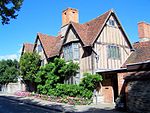
Church Street, Stratford-on-Avon
Geographical coordinates (GPS) Address Nearby Places Show on map
Geographical coordinates (GPS)
| Latitude | Longitude |
|---|---|
| N 52.1902 ° | E -1.7087 ° |
Address
Stratford-upon-Avon District Council
Church Street
CV37 6HX Stratford-on-Avon
England, United Kingdom
Open on Google Maps


