Lower Morava Valley
MoraviaValleys of the Czech RepublicWestern Carpathians

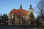
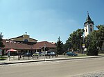
The Lower Morava Valley (Czech: Dolnomoravský úval; Slovak: Dolnomoravský úval; German: Nieder March Talsenke) is a geomorphological formation (special type of valley) in the Czech Republic and Slovakia. It is formed by the depression in the Western Carpathians (Ždánice Forest, Kyjov Hills and Mikulov Hills) in the west and Bílé Karpaty and Chvojnice Hills in the east. The drainage to the Morava River of the Danube basin runs finally to the Black Sea. It includes low watershed Dyje-Morava in Lanžhot.
Excerpt from the Wikipedia article Lower Morava Valley (License: CC BY-SA 3.0, Authors, Images).Lower Morava Valley
Hrubolúcka cesta,
Geographical coordinates (GPS) Address Nearby Places Show on map
Geographical coordinates (GPS)
| Latitude | Longitude |
|---|---|
| N 48.833333333333 ° | E 17.116666666667 ° |
Address
Hrubolúcka cesta
Hrubolúcka cesta
908 51 (Holíč)
Region of Trnava, Slovakia
Open on Google Maps


