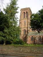
Whitley, Cheshire

Whitley is a civil parish in the unitary authority of Cheshire West and Chester and the ceremonial county of Cheshire, England. It is surrounded by the parishes of Antrobus, Comberbach, Little Leigh and Dutton. It also borders Daresbury in Halton borough as well as Hatton and Stretton in Warrington borough. It is a small village located next to Antrobus. The civil parish was created on 1 April 1936 based on Whitley Inferior and Whitley Superior, now known as Lower Whitley and Higher Whitley.Whitley lies mostly in the northern part of a triangle of land bounded by the A49 (Warrington to Whitchurch) to the west, the A559 (Warrington to Northwich) to the east and the A533 (Runcorn to Northwich) to the south.
Excerpt from the Wikipedia article Whitley, Cheshire (License: CC BY-SA 3.0, Authors, Images).Whitley, Cheshire
Bentley's Farm Lane,
Geographical coordinates (GPS) Address Nearby Places Show on map
Geographical coordinates (GPS)
| Latitude | Longitude |
|---|---|
| N 53.316 ° | E -2.573 ° |
Address
Bentley's Farm Lane
Bentley's Farm Lane
WA4 4QP , Whitley
England, United Kingdom
Open on Google Maps


