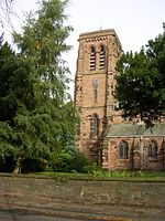
Higher Whitley
Cheshire West and ChesterCheshire geography stubsFormer civil parishes in CheshireVillages in Cheshire

Higher Whitley is a village and former civil parish, now in the parish of Whitley, in the unitary authority area of Cheshire West and Chester, in the ceremonial county of Cheshire, England. In 1931 the parish had a population of 339. It is north of Lower Whitley.
Excerpt from the Wikipedia article Higher Whitley (License: CC BY-SA 3.0, Authors, Images).Higher Whitley
Bentley's Farm Lane,
Geographical coordinates (GPS) Address Nearby Places Show on map
Geographical coordinates (GPS)
| Latitude | Longitude |
|---|---|
| N 53.316557 ° | E -2.574406 ° |
Address
Bentley's Farm Lane
Bentley's Farm Lane
WA4 4QN , Whitley
England, United Kingdom
Open on Google Maps


