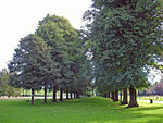
Antrobus, Cheshire

Antrobus is a civil parish and village in Cheshire, England, about 7 mi (11 km) south of Warrington. It lies within the unitary authority of Cheshire West and Chester, and had a population of 832, reducing to 791 at the 2011 Census, and to 767 in the 2021 Census. The parish is the most northeasterly point of Cheshire West and Chester, and as such borders both Warrington and Cheshire East. As well as Antrobus village centre itself, the parish includes other large hamlets at Frandley, about 1 mi (1.6 km) south-west from the main village, and Crowley, about 2 mi (3.2 km) to the north-east. The village shop and post office is owned and run cooperatively by the villagers for the benefit of the community having previously closed in 2003.
Excerpt from the Wikipedia article Antrobus, Cheshire (License: CC BY-SA 3.0, Authors, Images).Antrobus, Cheshire
School Lane,
Geographical coordinates (GPS) Address Phone number Website Nearby Places Show on map
Geographical coordinates (GPS)
| Latitude | Longitude |
|---|---|
| N 53.312 ° | E -2.536 ° |
Address
Antrobus St Mark's CofE Primary School
School Lane
CW9 6LB , Antrobus
England, United Kingdom
Open on Google Maps


