place

Wethersfield High School (Connecticut)

All pages needing cleanupPublic high schools in ConnecticutSchools in Hartford County, ConnecticutWethersfield, Connecticut

Wethersfield High School is a high school in Wethersfield, Connecticut, United States.

Excerpt from the Wikipedia article Wethersfield High School (Connecticut) (License: CC BY-SA 3.0, Authors).

Wethersfield High School (Connecticut)
Wolcott Hill Road,

Geographical coordinates (GPS) Address Phone number Website External links Nearby Places
placeShow on map

Wikipedia: Wethersfield High School (Connecticut)Continue reading on Wikipedia

Geographical coordinates (GPS)

Latitude Longitude
N 41.7077 ° E -72.6712 °
placeShow on map

Address

Wethersfield High School

Wolcott Hill Road 411
06109
Connecticut, United States
mapOpen on Google Maps

Phone number
Wethersfield Public Schools

call+18605718200

Website
wps.wethersfield.me

linkVisit website

linkWikiData (Q7990107)
linkOpenStreetMap (43438525)

Share experience

Nearby Places

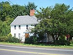
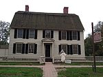
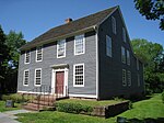
Old Wethersfield
Old Wethersfield

Old Wethersfield, also known as Old Wethersfield Historic District, and historically known as Watertown or Pyquag, is a section of the town of Wethersfield, Connecticut, roughly bounded by the borders of the adjacent city of Hartford and town of Rocky Hill, railroad tracks, and I-91. The site of the first permanent European-American settlement in the state of Connecticut, it was added to the National Register of Historic Places in 1970. The land for this colonial settlement was acquired from the Massachusetts Bay Colony. Wethersfield served as a transportation hub on the Connecticut River in the early years. The Old Wethersfield Historic District was established under town statutes in 1962, "to preserve and protect the many architectural phases of a Connecticut River Community in continual growth from 1634 to the present." Eight years later, in 1970, the Old Wethersfield Historic District was listed on the National Register of Historic Places. The village includes 50 houses that were built before the American Revolutionary War, plus about 250 additional houses built before the 20th century, about 100 of which were built earlier than the American Civil War.The historic district listed on the National Register includes 1200 structures over 1,300 acres (5.3 km2). Of these 100 date from colonial times. Many of the early frame and brick houses were built by sea captains around the town green.There are three National Historic Landmarks in Old Wethersfield: Buttolph–Williams House — 249 Broad St. Joseph Webb House — 211 Main St. Silas Deane House — 203 Main St.Another prominent historic building in the district is: First Church of Christ, WethersfieldThe district includes Wethersfield's green, which is "a slender diamond nearly a half-mile long".: 2 

First Church of Christ, Wethersfield

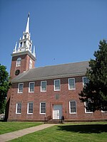
The First Church of Christ, Wethersfield, is an American Colonial Era church in the Old Wethersfield Historic District of Wethersfield, Connecticut. The congregation was founded in 1635, and the present Georgian style brick meetinghouse was built in 1761–1764 with its distinctive white steeple. The church cemetery also dates from the 1600s. The interior of the meetinghouse was built as a crosswise room (Querkirche), altered considerably in 1838 and 1882, and returned to the original layout in 1971–1973. According to a plaque at the tower entrance door, George Washington attended church there on May 20, 1781, during a conference with Count de Rochambeau at the nearby Joseph Webb House to plan the conclusion of the American Revolutionary War.John Adams visited Wethersfield resident and envoy to France Silas Deane in 1774 and wrote in his diary: “We went up the steeple of Wethersfield meeting-house, from whence is the most grand and beautiful prospect in the world, at least that I ever saw.”The church and its Austin organ hosted the first eighteen years of the Albert Schweitzer Organ Festival USA. This competition for young organists has been held annually since 1998 in the Hartford area, and was co-founded by First Church music minister David Spicer.The congregation was affiliated with the United Church of Christ from 1961 through 2004 when the congregation overwhelmingly voted to break away citing theological and social differences, including gay marriage.

Morgan G. Bulkeley Stadium

Morgan G. Bulkeley Stadium was a sporting event stadium located in Hartford, Connecticut and the site of Babe Ruth's final exhibition baseball game. The facility was home to the Eastern League's Hartford Senators, the Hartford Blues of the National Football League, and included a 1⁄5 mile dirt oval for motor sports. Originally named Clarkin Field from 1921–1927, the stadium was renamed for former Connecticut Governor and First President of the National League, Morgan Bulkeley in 1928.James H. Clarkin, owner of the Hartford Senators, replaced the old Wethersfield Avenue Baseball Grounds (also sometimes called Clarkin Field or Clarkin's Field) with the new Clarkin Field in 1921. After a series of rain delays, the ballpark finally opened on May 4, 1921.The ballpark was located at Hanmer Street and George Street off of Franklin Avenue. There was a fine playing surface laid out and Clarkin had erected one of the best minor league structures in the country, with a stand of steel and concrete and dressing rooms, shower baths and complete modern equipment. In 1927 fire destroyed the stand but it was rebuilt in less than a month. After only playing away games during the beginning of the season, the Hartford Senators returned to Hartford for a gala opening of Bulkeley Stadium in July 1927. According to the Hartford Courant, Clarkin died 6 years later on March 12, 1933. Between 1921 and 1952, the stadium was the home of Hartford's various minor league baseball teams: the Hartford Senators, Hartford Blues, Hartford Laurels, Hartford Bees, and Hartford Chiefs. Lou Gehrig, Jim Thorpe, Ty Cobb, Jimmie Foxx, Leo Durocher, Hank Greenberg, Warren Spahn, Ted Williams, and Johnny Sain all played at Bulkeley Stadium at one point in their careers. When the Boston Braves moved to Milwaukee at the end of the 1952 season, Hartford's minor league team was relocated. On September 30, 1945, George Herman "Babe" Ruth Jr. played in a charity game at Bulkeley Stadium for the Savitt Gems. The Gems were a semi-pro club sponsored by Bill Savitt who created the team in 1930 as part of the Greater Hartford Twilight Baseball League. At an old age of 50, Ruth entered the game as a pinch-hitter and grounded out to the opposing pitcher. The ballgame was Babe Ruth's final appearance of his playing career. Bulkeley Stadium fell into disarray and was demolished in 1960. The location of the stadium is currently a nursing home. A historical stone marker was dedicated there in 1998.Contemporary aerial photos and plans (shown on the GHTBL page) help to pin down the location more specifically. The diamond was in the northeast corner of the field. George Street bordered the right field fence. Hanmer Street and Goodrich Street ran to the third base side of the field from the east, and then continued westward from George Street. Chester Street was to the south, half a block beyond the left field fence. Cowles Street was to the north, nearly a block beyond the first base side. Franklin Avenue paralleled George Street, a block or more to the east of the ballpark and intersected by Hanmer and Goodrich. A convenient reference point is the Naylor School, which was and still is to southeast of the ballpark location, on the west side of Franklin between Chester and Cromwell. The 1940 city directory gives the address as 60 Hanmer.