St Denys
Areas of SouthamptonUse British English from February 2015
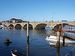
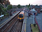
St Denys is a partially riverside district of Southampton, England, centred 1.5 miles (2.4 km) north north-east of the city centre facing variously Bitterne Park and quay across the River Itchen estuary. The river is here spanned in the mid-east extreme of the district by Cobden Bridge, one of five within the city's broad boundaries, six including the railway bridge 100 m south. It is separated from the city centre by the districts sometimes known as Bevois Valley and New Town, in turn.
Excerpt from the Wikipedia article St Denys (License: CC BY-SA 3.0, Authors).St Denys
Dundee Road, Southampton Saint Denys
Geographical coordinates (GPS) Address Website Nearby Places Show on map
Geographical coordinates (GPS)
| Latitude | Longitude |
|---|---|
| N 50.925 ° | E -1.384 ° |
Address
St Denys Primary School
Dundee Road
SO17 2ND Southampton, Saint Denys
England, United Kingdom
Open on Google Maps


