Portswood
Use British English from October 2013Wards of Southampton

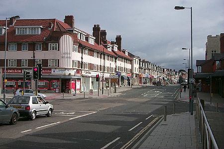
Portswood is a suburb and Electoral Ward of Southampton, England. The suburb lies to the north-north-east of the city centre and is bounded by (clockwise from west) Freemantle, Highfield, Swaythling, St. Denys and Bevois Valley. Portswood Ward comprises Portswood, Highfield and St. Denys, and had a population of 14,831 at the 2011 Census. It is a largely residential area adjacent to the main campus of the University of Southampton, and as such more than a quarter of residents are students.
Excerpt from the Wikipedia article Portswood (License: CC BY-SA 3.0, Authors, Images).Portswood
Portswood Road, Southampton Portswood
Geographical coordinates (GPS) Address Nearby Places Show on map
Geographical coordinates (GPS)
| Latitude | Longitude |
|---|---|
| N 50.9261 ° | E -1.3931 ° |
Address
Roebridge
Portswood Road 217;217a
SO17 2NF Southampton, Portswood
England, United Kingdom
Open on Google Maps


