place

Catacombs (sex club)

BDSM stubsGay bathhouses in CaliforniaLGBT BDSMLGBT in CaliforniaLGBT stubs
Leather subcultureSexuality in San FranciscoSouth of Market, San Francisco

The Catacombs was a gay and lesbian S/M leather fisting club in the South of Market area of San Francisco, which operated from 1975 to 1981, and reopened at another location from 1982 to 1984. It was the most famous fisting club in the world. The founder and owner was Steve McEachern. The location was semi-secret and admission was by referral only. It was originally a gay men's club, and Cynthia Slater persuaded the management to open up to lesbians. Among the patrons was Patrick Califia, known then as Pat Califia. The Catacombs has been exhaustively described by sexual anthropologist Gayle Rubin, who calls it "exemplary" in its attempts to deal with the AIDS crisis which would eventually lead to its closure. Patrick Moore devotes a chapter to it in his Beyond Shame: Reclaiming the Abandoned History of Radical Gay Sexuality. Sex educator Carol Queen called it "the place to be seen and to play at during the 1980s."The San Francisco South of Market Leather History Alley consists of four works of art along Ringold Alley honoring leather culture; it opened in 2017. One of the works of art is metal bootprints along the curb which honor 28 people, including Catacombs founder and owner Steve McEachern, who were an important part of the leather communities of San Francisco.

Excerpt from the Wikipedia article Catacombs (sex club) (License: CC BY-SA 3.0, Authors).

Catacombs (sex club)
21st Street, San Francisco

Geographical coordinates (GPS) Address Nearby Places
placeShow on map

Wikipedia: Catacombs (sex club)Continue reading on Wikipedia

Geographical coordinates (GPS)

Latitude Longitude
N 37.7568523 ° E -122.4244217 °
placeShow on map

Address

21st Street 3442;3444;3446
94143 San Francisco
California, United States
mapOpen on Google Maps

Share experience

Nearby Places

Mission Dolores Park

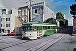
Mission Dolores Park, often abbreviated to Dolores Park, is a city park in San Francisco, California. It is located two blocks south of Mission Dolores at the western edge of the Mission District. Dolores Park is bounded by 18th Street on the north, 20th Street on the south, Dolores Street on the east and Church Street on the west. The northern end of Dolores Park is located directly across the street from Mission High School. On its eastern, southern and western sides, the park is surrounded by residential buildings of two to four stories, in various architectural styles. South of the park is a hillside area known as "Dolores Heights," while The Castro neighborhood is located a short distance to the west. The park's topography is characterized by a strong slope from the southwest down to the northeast, offering an unobstructed northeast-looking view of downtown San Francisco, in particular from the southwest corner.Dolores Park offers several features including many tennis courts, a basketball court, a multi-purpose court, a soccer field, a pissoir, a children's playground, and a dog play area. The southern half of the park is also notable for its views of the Mission district, downtown, the San Francisco Bay and the East Bay. The Muni Metro J-Church streetcar line runs through the park along its western border. The park lies east of Twin Peaks in the warm and sunny microclimate of the Mission neighborhood, which was named one of the coolest neighborhoods in the world in 2016. In recent years, the park's popularity among San Franciscans looking for outdoor relaxation and recreation has increased, and as of 2016 it was attracting up to 7,000–10,000 people on a sunny weekend day.