place

Clare Castle Country Park

Clare, SuffolkCountry parks in SuffolkSuffolk geography stubs
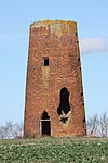
Station Road, Clare Country Park geograph.org.uk 980585

Clare Castle Country Park in Suffolk, England, was created around the ruins of Clare Castle and incorporates the now defunct Clare railway station on the Colchester to Cambridge branch of the Great Eastern Railway. There are several walks through the park and along the River Stour, as well as a nature trail, and the park lies on the Stour Valley Path and forms the end of the Bury to Clare walk. There is also a visitors centre in the former station with pictures of the site in former years.

Excerpt from the Wikipedia article Clare Castle Country Park (License: CC BY-SA 3.0, Authors, Images).

Clare Castle Country Park
Ladies Walk, West Suffolk

Geographical coordinates (GPS) Address Nearby Places
placeShow on map

Wikipedia: Clare Castle Country ParkContinue reading on Wikipedia

Geographical coordinates (GPS)

Latitude Longitude
N 52.0771 ° E 0.5837 °
placeShow on map

Address

Clare Castle

Ladies Walk
CO10 8NJ West Suffolk
England, United Kingdom
mapOpen on Google Maps

Station Road, Clare Country Park geograph.org.uk 980585
Share experience

Nearby Places

Knowl Green
Knowl Green

Knowl Green is a hamlet in the civil parish of Belchamp St Paul and the Braintree district of Essex, England. The hamlet is approximately 6 miles (10 km) west from the town of Sudbury, Suffolk and 23 miles (37 km) north-northeast from the county town and city of Chelmsford. It is where Gage's Road from Belchamp St Paul village at the north-east, and Belchamps Road from Tilbury Juxta Clare at the south-west, meet at the junction of Pollard's Green Lane which leads north to Ovington. Knowl Green comprises houses, cottages, two farms with associated buildings, and the Cherry Tree public house. The Cherry Tree was recorded as such in 1933. An arm of Belchamp Brook, a tributary of the River Stour, rises at the north of Knowl Green and flows by the hamlet.There are seven Grade II listed buildings in Knowl Green. Hole Farmhouse is an early 19th-century timber-framed house at the north of the junction, with, 44 yards (40 m) to the south, an associated timber-framed and weatherboarded late 19th-century cartshed. Woodbarn's Farmhouse, at the south of the junction, is a timber-framed and plastered house dating to the 15th century. At the west of the hamlet on Belchamp Road are two conjoined two-storey 18th-century cottages, timber-framed, with brick corners and flint infill. At the east of the hamlet at the north side of Gage's Road is a 17th-century timber-framed thatch-roofed cottage. Opposite, and set back at the south of the road is a further 17th-century timber-framed thatch-roofed cottage. Near this cottage, and on Gage's Road, is The Cherry Tree Inn, timber-framed and plastered, and with gable dormers, dating to the late 17th century, with a 20th-century extension.