Chilbolton
Hampshire geography stubsTest ValleyVillages in Hampshire

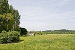
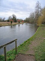
Chilbolton is a village and civil parish in Hampshire, England, near to Stockbridge. It is situated 18 miles (29 km) north of Southampton and four miles (6.4 km) south of Andover. Its most notable feature is the Chilbolton Observatory situated on the disused RAF Chilbolton airfield. The parish church of St Mary the Less dates back to the 12th century, on the site of an earlier wooden church. The River Test runs through Chilbolton Common. Chilbolton is recorded in the Domesday Book under the name Cilbodentune.
Excerpt from the Wikipedia article Chilbolton (License: CC BY-SA 3.0, Authors, Images).Chilbolton
Village Street, Test Valley Chilbolton
Geographical coordinates (GPS) Address Nearby Places Show on map
Geographical coordinates (GPS)
| Latitude | Longitude |
|---|---|
| N 51.1569 ° | E -1.4387 ° |
Address
Village Street
SO20 6BE Test Valley, Chilbolton
England, United Kingdom
Open on Google Maps


