Bull Gap (Buncombe County, North Carolina)
Blue Ridge ParkwayLandforms of Buncombe County, North CarolinaMountain passes of North CarolinaNorth Carolina road stubsTransportation in Buncombe County, North Carolina

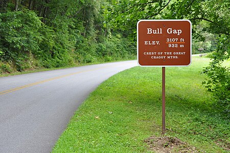
Bull Gap (el. 3,107 ft (947 m)) is a mountain pass on Bull Mountain, part of the Great Craggy Mountains. Though the Blue Ridge Parkway doesn't go through the gap, it is the most immediate to it and is accessible by hiking.
Excerpt from the Wikipedia article Bull Gap (Buncombe County, North Carolina) (License: CC BY-SA 3.0, Authors, Images).Bull Gap (Buncombe County, North Carolina)
Ox Creek Road,
Geographical coordinates (GPS) Address Nearby Places Show on map
Geographical coordinates (GPS)
| Latitude | Longitude |
|---|---|
| N 35.6698352 ° | E -82.4712368 ° |
Address
Ox Creek Road
North Carolina, United States
Open on Google Maps


