Uriage-les-Bains
Geography of IsèreSpa towns in France

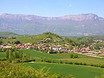
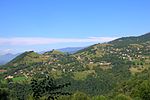
Uriage-les-Bains (or Uriage) is a spa town in France, at 414 m (1,358 ft) above sea level. Uriage is attached to the communes of Saint-Martin-d'Uriage and Vaulnaveys-le-Haut and is located in the department of Isère, beneath the ski resort of Chamrousse. The inhabitants are called the Uriageois (es). Uriage does not have the status of a municipality. Uriage is served by the departmental road 524, which is the old N524 from Grenoble to Vizille, through Gières.
Excerpt from the Wikipedia article Uriage-les-Bains (License: CC BY-SA 3.0, Authors, Images).Uriage-les-Bains
Avenue d'Uriage, Grenoble
Geographical coordinates (GPS) Address Nearby Places Show on map
Geographical coordinates (GPS)
| Latitude | Longitude |
|---|---|
| N 45.1374 ° | E 5.8255 ° |
Address
Avenue d'Uriage
Avenue d'Uriage
38410 Grenoble
Auvergne-Rhône-Alpes, France
Open on Google Maps


