Hüttenberg (Haardt)
Mountains and hills of the Palatinate ForestMountains under 1000 metres

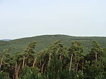
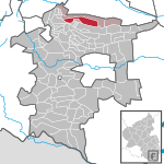
The Hüttenberg near Maikammer in the Rhineland-Palatinate county of Südliche Weinstraße is a subpeak, 620.1 m above sea level (NN), of the Kalmit (672.6 m) the highest mountain in the Haardt in the eastern Palatinate Forest of Germany. There is a blockfield, the Hüttenberg Felsenmeer, along the crest.
Excerpt from the Wikipedia article Hüttenberg (Haardt) (License: CC BY-SA 3.0, Authors, Images).Hüttenberg (Haardt)
Emil-Ohler-Pfad,
Geographical coordinates (GPS) Address Nearby Places Show on map
Geographical coordinates (GPS)
| Latitude | Longitude |
|---|---|
| N 49.33222 ° | E 8.070639 ° |
Address
Emil-Ohler-Pfad
67434
Rhineland-Palatinate, Germany
Open on Google Maps


