Schafkopf (Haardt)
Mountains and hills of Rhineland-PalatinateMountains and hills of the Palatinate ForestMountains under 1000 metresRhineland-Palatinate geography stubsSüdliche Weinstraße

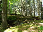
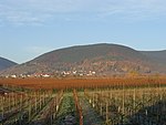
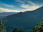
The Schafkopf, with its height of 616.8 metres, is one of the few mountains of the Palatine Forest that exceeds the 600 metre mark. It lies south of the Forest's highest peak, the Kalmit, in the Palatine Forest-North Vosges Biosphere Reserve, not far from the municipality of St. Martin and, together with the Morschenberg (608 m), Rotsohlberg (607 m) and Steigerkopf (614 m), forms a contiguous massif. The Schafkopf is entirely forested. There are no official paths or tracks to the actual summit.
Excerpt from the Wikipedia article Schafkopf (Haardt) (License: CC BY-SA 3.0, Authors, Images).Schafkopf (Haardt)
Totenkopfstraße, Maikammer
Geographical coordinates (GPS) Address Nearby Places Show on map
Geographical coordinates (GPS)
| Latitude | Longitude |
|---|---|
| N 49.31306 ° | E 8.04944 ° |
Address
Totenkopfstraße
67487 Maikammer
Rhineland-Palatinate, Germany
Open on Google Maps


