Beech Street (London)

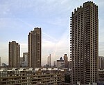
Beech Street is a street in the City of London. It was formerly known as Beech Lane and was named after Nicholas de la Beche, a lieutenant of the Tower of London in the reign of Edward III in the 14th century. It runs west-east, from its junction with Aldersgate Street and Long Lane in the west, to the junction with Whitecross Street, Silk Street and Chiswell Street in the east. The eastern junction marks the boundary of the City with Islington: Whitecross and Chiswell (north and east) are in Islington, while Beech and Silk (west and south) are in the City. The majority of the street is in a pseudo-tunnel under the Barbican estate. On 18 March 2020 the street became the UK's first "zero emission street", only allowing access to pedestrians, cyclists, and zero emission vehicles. This remained in effect until September 2021, and in December that year members of the City of London corporation voted for a public consultation into making the scheme permanent.Access to several of the Barbican car parks is from Beech Street.
Excerpt from the Wikipedia article Beech Street (London) (License: CC BY-SA 3.0, Authors, Images).Beech Street (London)
Lauderdale Place, City of London
Geographical coordinates (GPS) Address Nearby Places Show on map
Geographical coordinates (GPS)
| Latitude | Longitude |
|---|---|
| N 51.520613888889 ° | E -0.094541666666667 ° |
Address
Beech Gardens
Lauderdale Place
EC2Y 8EN City of London
England, United Kingdom
Open on Google Maps


