Monkwell Square
Streets in the City of LondonUse British English from January 2018

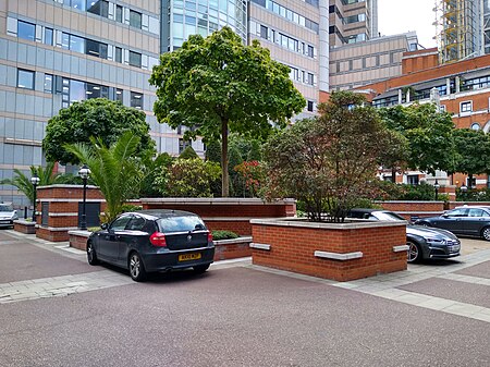
Monkwell Square is a London street and garden square. It forms part of the Barbican estate, and lies to the west of Wood Street. The Worshipful Company of Barbers Barber-Surgeons' Hall was established in Monkwell Street in the 14th century. The Hall survived the Great Fire, but was destroyed by enemy bombing in the London Blitz in the Second World War. The modern hall was rebuilt approximately 10m to the east of the former site, in Monkwell Square.
Excerpt from the Wikipedia article Monkwell Square (License: CC BY-SA 3.0, Authors, Images).Monkwell Square
London Wall, City of London
Geographical coordinates (GPS) Address Nearby Places Show on map
Geographical coordinates (GPS)
| Latitude | Longitude |
|---|---|
| N 51.5177 ° | E -0.09396 ° |
Address
London Wall 125
EC2Y 5AS City of London
England, United Kingdom
Open on Google Maps


