place

Stonehenge (building)

Apartment buildings in New JerseyBuildings and structures in Hudson County, New JerseyModernist architecture in New JerseyNorth Bergen, New JerseyNorth Hudson, New Jersey
Residential buildings completed in 1967Residential skyscrapers in New JerseyRound buildingsSkyscrapers in New JerseyTowers in New Jersey
StonehengeNorthBergen

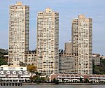
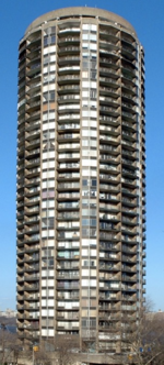
The Stonehenge is a residential apartment building on Boulevard East in the Woodcliff section of North Bergen, New Jersey in the United States. Situated adjacent to North Hudson Park, the building was constructed in 1967 during a high-rise building spree and at 369 feet (112 m) is among the tallest buildings in the area. The 34-story building has 356 apartments and 5 levels of indoor parking.

Excerpt from the Wikipedia article Stonehenge (building) (License: CC BY-SA 3.0, Authors, Images).

Stonehenge (building)
Bulls Ferry Road,

Geographical coordinates (GPS) Address Nearby Places
placeShow on map

Wikipedia: Stonehenge (building)Continue reading on Wikipedia

Geographical coordinates (GPS)

Latitude Longitude
N 40.7995 ° E -73.9962 °
placeShow on map

Address

Bulls Ferry Road

Bulls Ferry Road
07022
New Jersey, United States
mapOpen on Google Maps

StonehengeNorthBergen
Share experience

Nearby Places

Bulls Ferry
Bulls Ferry

Bulls Ferry (also Bull's Ferry) is an area along the Hudson River, just north of Weehawken Port Imperial in the towns of West New York, Guttenberg and North Bergen in New Jersey. It takes its name from a pre-Revolutionary settlement belonging to the Bull family, who operated a row-and-sail ferry to the burgeoning city of New York across the river.During the Revolutionary War, the British built and occupied a blockhouse in the area of Bull's Ferry, an area known to the British as Block House Point. This fort was the site of several skirmishes between the British and American forces. Brigadier General Anthony Wayne led American troops from New Bridge on a raid against the blockhouse on July 20, 1780, in the Battle of Bull's Ferry. After the raid, the blockhouse was abandoned when British troops decamped to the fort at Bergen Neck.Like Burdett's Landing to the north, Bull's Ferry was a crucial crossing point well into the 19th century. Ferry service continued for several decades until steam ferries, notably from Hoboken, replaced the earlier, brute-force rowing service. Larger terminals to the north at Edgewater and south at the West Shore Railroad Terminal operated until the 1950s. Modern ferries still commute to Manhattan out of Port Imperial in Weehawken, Hoboken and Paulus Hook in Jersey City (as well as Sandy Hook on the Jersey shore).A number of roads ran down the Hudson Palisades to the ferry slip. Bull's Ferry Road was the original name of Park Avenue and Woodcliff Avenues up on the palisades in North Hudson, and is still used for a street winding around the Stonehenge Tower and descending from Boulevard East to River Road in North Bergen. Another, simply called Ferry Road, passes under the Galaxy Towers which overlook the neighborhood. The slip itself was close to the part of Edgewater once known as Shadyside.Since the 1980s, previous industrial and maritime uses of the area at the foot of the Palisades have given way to residential, institutional and recreational development, including the Palisades Medical Center and the Hudson River Waterfront Walkway. The district's major thoroughfare is commonly known as River Road, which is served by New Jersey Transit routes 158 and 188 and NY Waterway buses, with connecting service to Weehawken Port Imperial.In April 2011, Guttenberg, and North Bergen agreed to jointly build a park south of Palisades Medical Center, which would include a waterfront promenade. The Hudson River Waterfront Walkway is an esplanade along the water's edge from Bayonne to Fort Lee.
Woodcliff, North Bergen

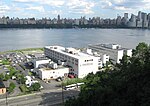
Woodcliff is a neighborhood in northeastern North Bergen, New Jersey. The center of area is a large Hudson County park known as North Hudson Park, which refers to the collective name of the municipalities in northern part of the county, and is officially named for James J. Braddock, an American boxer who was a resident the township. The boomerang-shaped section north of the park is bordered by the southeastern Bergen County towns of Cliffside Park and Fairview, is characterized by a garden apartment complex called Woodcliff Gardens. The neighborhood south of the park is bordered by Boulevard East and Bergenline Avenue, across from which is North Bergen Public Library and the Racetrack Section. It southern border is shared with the borough of Guttenberg. High density housing includes single and multi-family dwellings as well as low-rise and high-rise apartment buildings. The section was developed early 1900s by the Woodcliff Land Improvement Company, organized by Hamilton V. Meeks in 1891. It is sometimes occasionally still called Hudson Heights. Located atop the Hudson Palisades, much of Woodcliff overlooks the Hudson River and the neighborhoods along its banks, Shadyside and Bulls Ferry, to which it is connected by a colonial era road along the face of the cliff. The Woodcliff Treatment Plant is located at the foot of the escarpment.Woodcliff is served by New Jersey Transit local and Manhattan-bound buses, as well numerous privately operated carritos, dollar vans and mini-buses originating at Nungesser's, a major intersection.

Racetrack Section, North Bergen

The Racetrack Section, also known as Hudson Heights, is a neighborhood of North Bergen Township in Hudson County, New Jersey, United States. It is a mostly residential district between Bergenline and Kennedy Boulevard. Its east–west streets follow the numbering of other North Hudson towns while its north–south streets are called avenues and are numbered First, Second, Third, Fourth, and Fifth. Located on the plateau of the Hudson Palisades (which begin their descent at the Boulevard) the Racetrack Section consists of mostly one and two family homes and enjoys convenient public transportation, a stable population, and proximity to North Bergen Public Library, North Bergen High School, North Hudson Park and Woodcliff. The neighborhood takes its name from Nungesser's Guttenberg Racetrack. The racetrack located in the area was a popular with day-trippers from New York (who traveled by streetcar from the elevator at the Weehawken Ferry) during the latter part of the 19th century, until gaming was outlawed by the New Jersey legislature in 1893. While the tracks closed, the area remained an amusement park known as Little Coney Island. The "pleasure resort" as it was known, gained a reputation as attracting a similarly rowdy crowd as the racetrack, and reported incidents of alcohol being served to children and women being drugged. The recently invented ice cream cone was popularized at the park. The track was later used as a roadhouse for automobilists until the former clubhouse burned down in 1910. The site became a known landing spot for early aviators. The land on which the racetrack had been was subdivided in 1919, and later was built upon creating the section which exists today. . White Castle, an early drive-in fast-food chain, has long been located in the neighborhood.The district is still sometimes called Hudson Heights or Nungesser's, which is more commonly used to describe the intersection and transportation hub at the northwest corner of North Hudson Park, at the Bergen line with Fairview border.