place

Battle of Bolivar Heights

1861 in VirginiaAmerican Civil War battle stubsBattles of the American Civil War in West VirginiaBattles of the Eastern Theater of the American Civil WarJefferson County, West Virginia in the American Civil War
October 1861 events
Bolivar Heights sign

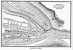
The Battle of Bolivar Heights (October 16, 1861) was an early battle of the American Civil War. Bolivar Heights is a plateau which overlooks the towns of Harpers Ferry, West Virginia and Bolivar, West Virginia, then part of Virginia.

Excerpt from the Wikipedia article Battle of Bolivar Heights (License: CC BY-SA 3.0, Authors, Images).

Battle of Bolivar Heights
Bolivar Heights Trail,

Geographical coordinates (GPS) Address Nearby Places
placeShow on map

Wikipedia: Battle of Bolivar HeightsContinue reading on Wikipedia

Geographical coordinates (GPS)

Latitude Longitude
N 39.323611111111 ° E -77.761388888889 °
placeShow on map

Address

Bolivar Heights Trail

Bolivar Heights Trail
25432
West Virginia, United States
mapOpen on Google Maps

Bolivar Heights sign
Share experience

Nearby Places

Harpers Ferry Historic District

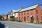
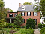
The Harpers Ferry Historic District comprises about one hundred historic structures in Harpers Ferry, West Virginia. The historic district includes the portions of the central town not included in Harpers Ferry National Historical Park, including large numbers of early 19th-century houses built by the United States Government for the workers at the Harpers Ferry Armory. Significant buildings and sites include the site of the Armory, the U.S Armory Potomac Canal, the Harpers Ferry Train Station, and Shenandoah Street, Potomac Street, and High or Washington Street. The National Historic Park essentially comprises the lower, flood-prone areas of the town, while the Historic District comprises the upper town. In the late 19th century a number of Victorian and Federalist-style houses were built on the high ground and received guests who included Mark Twain, Alexander Graham Bell and Woodrow Wilson. "Stonewall" Jackson also made the town his base of command during part of the Civil War and Thomas Jefferson said of the ferry area that: "The passage of the Patowmac through the Blue Ridge is perhaps one of the most stupendous scenes in Nature." The historic district preserves what is essentially an intact 19th-century town that occupied a pivotal role in the American Civil War, and later as a transportation center. Thousands of tourists visit the town every year, however, parking in town is scarce. In order to better manage traffic in the small streets and enhance the feel of this historic town visitors are asked to park at the nearby Visitors Center and take the Park Service bus into the town itself. Taking the bus gives visitors a view of the traditional infrastructure that made Harpers Ferry so important prior to the 20th century. A commuter train line stops at Harpers Ferry's historic train station and links the town with Washington D.C., with many intermediate stops.The town was severely damaged during the Civil War, and the Armory, the only large employer, was destroyed; the only surviving building is the fire engine house, called John Brown's Fort, which is not at its original location (it traveled to Chicago and back). In addition, there was repetitive flooding in the late 19th and early 20th centuries. in the inadvertent preservation of much of the original town fabric. Two National Register properties adjoin the Harpers Ferry Historic District—the B & O Railroad Potomac River Crossing and St. Peter's Roman Catholic Church.

Harpers Ferry, West Virginia

Harpers Ferry is a historic town in Jefferson County, West Virginia, United States, in the lower Shenandoah Valley. The population was 285 at the 2020 census. Situated at the confluence of the Potomac and Shenandoah rivers, where the U.S. states of Maryland, Virginia, and West Virginia meet, it is the easternmost town in West Virginia. During the American Civil War, it was the northernmost point of Confederate-controlled territory. An 1890 history book on the town called it "the best strategic point in the whole South."The town was formerly spelled Harper's Ferry with an apostrophe, so named because in the 18th century it was the site of a ferry service owned and operated by Robert Harper. The United States Board on Geographic Names, whose Domestic Name Committee is reluctant to include apostrophes in official place names, established the standard spelling of "Harpers Ferry" by 1891.By far, the most important event in the town's history was John Brown's raid on the Harpers Ferry Armory in 1859.Prior to the American Civil War, Harpers Ferry was a manufacturing town as well as a major transportation hub. The main economic activity in the town in the 20th and 21st centuries is tourism. John Brown's Fort is the most visited tourist site in the state of West Virginia. The headquarters of the Appalachian Trail are there—not the midpoint, but close to it, and easily accessible—and the buildings of the former Storer College are used by the National Park Service for one of its four national training centers. The National Park Service is Harpers Ferry's largest employer in the 21st century.The lower town has been reconstructed by the National Park Service. It was in ruins by the end of the American Civil War, not helped by later river flooding.: 15  "The fact that Harpers Ferry was first and foremost an industrial village during the 19th century is not apparent in the sights, sounds, or smells of the town today.": 10