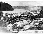
Harpers Ferry, West Virginia

Harpers Ferry is a historic town in Jefferson County, West Virginia, United States, in the lower Shenandoah Valley. The population was 285 at the 2020 census. Situated at the confluence of the Potomac and Shenandoah rivers, where the U.S. states of Maryland, Virginia, and West Virginia meet, it is the easternmost town in West Virginia. During the American Civil War, it was the northernmost point of Confederate-controlled territory. An 1890 history book on the town called it "the best strategic point in the whole South."The town was formerly spelled Harper's Ferry with an apostrophe, so named because in the 18th century it was the site of a ferry service owned and operated by Robert Harper. The United States Board on Geographic Names, whose Domestic Name Committee is reluctant to include apostrophes in official place names, established the standard spelling of "Harpers Ferry" by 1891.By far, the most important event in the town's history was John Brown's raid on the Harpers Ferry Armory in 1859.Prior to the American Civil War, Harpers Ferry was a manufacturing town as well as a major transportation hub. The main economic activity in the town in the 20th and 21st centuries is tourism. John Brown's Fort is the most visited tourist site in the state of West Virginia. The headquarters of the Appalachian Trail are there—not the midpoint, but close to it, and easily accessible—and the buildings of the former Storer College are used by the National Park Service for one of its four national training centers. The National Park Service is Harpers Ferry's largest employer in the 21st century.The lower town has been reconstructed by the National Park Service. It was in ruins by the end of the American Civil War, not helped by later river flooding.: 15 "The fact that Harpers Ferry was first and foremost an industrial village during the 19th century is not apparent in the sights, sounds, or smells of the town today.": 10
Excerpt from the Wikipedia article Harpers Ferry, West Virginia (License: CC BY-SA 3.0, Authors, Images).Harpers Ferry, West Virginia
Henry Clay Street Greenway,
Geographical coordinates (GPS) Address Nearby Places Show on map
Geographical coordinates (GPS)
| Latitude | Longitude |
|---|---|
| N 39.324166666667 ° | E -77.733888888889 ° |
Address
Henry Clay Street Greenway
Henry Clay Street Greenway
25410
West Virginia, United States
Open on Google Maps


