Ward Hill, Massachusetts
Essex County, Massachusetts geography stubsHaverhill, MassachusettsNeighborhoods in MassachusettsPopulated places in Essex County, MassachusettsUse mdy dates from July 2023

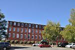
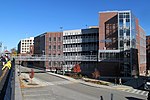
Ward Hill is a neighborhood in Haverhill, Essex County, Massachusetts. Its coordinates are at 42°45′N 71°06′W. It is bordered on the northeast and west by the Merrimack River. Main roads include the Massachusetts Route 125 called South Main Street where it passes through, the Connector road to I-495 exit 48 and I-495 where it is called the Blue Star Memorial Highway. It also has a hill called Ward Hill and an island called Kimball Island on the river bank on the west. Other places in this neighborhood include the Whittier Rehabilitation Hospital.
Excerpt from the Wikipedia article Ward Hill, Massachusetts (License: CC BY-SA 3.0, Authors, Images).Ward Hill, Massachusetts
Dorian Drive, Haverhill
Geographical coordinates (GPS) Address Nearby Places Show on map
Geographical coordinates (GPS)
| Latitude | Longitude |
|---|---|
| N 42.75 ° | E -71.1 ° |
Address
Dorian Drive 19
01832 Haverhill
Massachusetts, United States
Open on Google Maps


