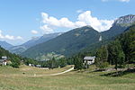
Col de la Ruchère
France geography stubsMountain passes of Auvergne-Rhône-AlpesMountain passes of the Alps

The Col de la Ruchère is a mountain pass located at 1,407 m above sea level, in the township of Saint-Christophe-sur-Guiers in the Chartreuse Mountains between the Riondettes meadow at La Ruchère and the Grande Chartreuse monastery. This pass is only accessible by foot: from the south, fully wooded, 2 hours 30 minutes walk from Correrie at the entrance of the silence zone of the monastery; from the north, overlooking a pasture, 1 hour 30 minutes walk from the hamlet of La Ruchère or from its northern winter sports resort area.
Excerpt from the Wikipedia article Col de la Ruchère (License: CC BY-SA 3.0, Authors, Images).Col de la Ruchère
GRP Tour de Chartreuse, Grenoble
Geographical coordinates (GPS) Address Nearby Places Show on map
Geographical coordinates (GPS)
| Latitude | Longitude |
|---|---|
| N 45.386388888889 ° | E 5.7980555555556 ° |
Address
Col de la Ruchère
GRP Tour de Chartreuse
38380 Grenoble
Auvergne-Rhône-Alpes, France
Open on Google Maps


