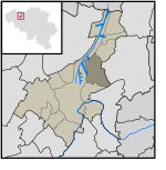
Port of Ghent

The Port of Ghent is the third busiest seaport in Belgium, located in Ghent, East Flanders in the Flemish Region. The first port of Ghent was situated at the river Scheldt and later on at the Leie. Since the Middle Ages Ghent has sought for a connection to the sea. In the 13th century via the Lieve canal to the Zwin near Damme, in the 16th century via the Sassevaart, in the 17th century via the Ghent–Bruges canal. Since the 19th century, the Ghent–Terneuzen Canal connects the port via the Western Scheldt to the North Sea. The port of Ghent is accessible by ships of the Panamax size, and in February 2015 the construction of a new lock at Terneuzen was announced, which will maintain near-parity with those of the Panama Canal expansion project.
Excerpt from the Wikipedia article Port of Ghent (License: CC BY-SA 3.0, Authors, Images).Port of Ghent
Scheepzatestraat, Ghent
Geographical coordinates (GPS) Address Nearby Places Show on map
Geographical coordinates (GPS)
| Latitude | Longitude |
|---|---|
| N 51.105833333333 ° | E 3.74 ° |
Address
Scheepzatestraat
Scheepzatestraat
9000 Ghent (Ghent)
East Flanders, Belgium
Open on Google Maps


