Union Park, Saint Paul
1880 establishments in Minnesota1884 disestablishments in the United StatesParks in Saint Paul, Minnesota

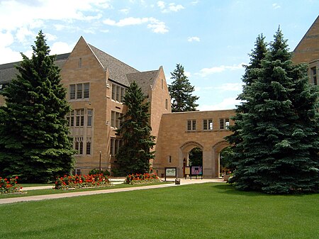
Union Park is a neighborhood in Saint Paul in the U.S. state of Minnesota. Created as a merger of several historic neighborhoods including Merriam Park, Snelling-Hamline, and Lexington-Hamline, it is bordered by University Avenue on the north, Lexington Parkway on the east, Summit Avenue on the south, and the Mississippi National River and Recreation Area on the west.
Excerpt from the Wikipedia article Union Park, Saint Paul (License: CC BY-SA 3.0, Authors, Images).Union Park, Saint Paul
East Lynnhurst Avenue, Saint Paul Union Park
Geographical coordinates (GPS) Address Nearby Places Show on map
Geographical coordinates (GPS)
| Latitude | Longitude |
|---|---|
| N 44.955833333333 ° | E -93.180277777778 ° |
Address
East Lynnhurst Avenue 481
55104 Saint Paul, Union Park
Minnesota, United States
Open on Google Maps


